
Places near here
Photo credits
- N Chadwick, Geograph · CC BY-SA 2.0
- Linda Bailey, Wikimedia Commons · CC BY-SA 2.0
- Kenneth Allen, Wikimedia Commons · CC BY-SA 2.0
- Alun Salt, Wikimedia Commons · CC BY-SA 2.0
- Anne Burgess, Wikimedia Commons · CC BY-SA 2.0
- Kenneth Allen, Geograph · CC BY-SA 2.0
 Lough FeaWalking route · 1.3 mi
Explorer Tom Lough Fea in County Derry has strict rules for visitors, the main one being that if you drop your phone in, it becomes a permanent part of its collection. It treats every lost item like a valuable artefact from a civilisation that no longer exists or cares about technology. Ten minutes here and you'll have a yarn for the pub.
 Slieve GallionMountain / peak · 3.5 mi
Explorer Tom Slieve Gallion in County Derry claims it knows everyone from the local GAA team to the vicar, which is exactly how you know it’s lying through its granite teeth. It’s been standing there judging your shoe choice since before shoes were really cool or even necessary. Whisper a secret at it, it's kept worse.
 Lissan HouseCountry House · 3.6 mi
Explorer Tom Lissan House in County Tyrone has had a terrible poem written about it by someone who clearly hadn’t finished their second pint, rhyming 'house' with 'mouse'. The building looks down on them all, pretending the whole thing never happened and that it’s actually quite refined. Find a local and ask them the real story, then come back and tell me.
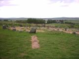 Beaghmore Stone CirclesVisitor information · 3.9 mi
Explorer Tom These Beaghmore Stone Circles brag about surviving a massive storm in 1920 where every other rock nearby got knocked over. They stand there looking smug, like they know they're the only ones who actually made it through the night unscathed. Look up, the best bit is always higher than you think.
 Wellbrook Beetling MillGallery/ Museum · 3.9 mi
Explorer Tom Wellbrook Beetling Mill in Corkhill is trying to look dignified while its lade gurgles like a drunk uncle. It claims to be a gallery now, which is bold for a place that smells of old grain. Bring curiosity, leave with a better story than mine.
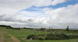 BeaghmoreArchaeological place · 3.9 mi
Explorer Tom Beaghmore nearly got famous when a tourist mistook one of its stone circles for a very ancient hula hoop. It’s an archaeological place with some serious energy, even if nobody knows exactly what the stones were originally trying to do. Bring a pen pal, they'll be jealous.
 Ecclesiastical enclosure round lissan church (Ldy 046:001) in Tullynure, ChurchtownEcclesiastical Enclosure round Lissan Church (ldy 046:001) · 3.9 mi
Explorer Tom Ecclesiastical enclosure round Lissan Church in Tullynure is sick of people asking if the ghost pays rent. It's just an old church with strong opinions. A good place to forget your phone for ten minutes.
 Beaghmore Stone Circle CArchaeological place · 3.9 mi
Explorer Tom Beaghmore Stone Circle C is in a bitter feud with the rain, convinced that if it could just get one dry day, it would finally reveal its true secret to the world. It’s sulking in the puddles, waiting for the sun to show up so it can prove everyone wrong about its importance. Grand place for a sulk or a snog, your call.
 Drum Manor Forest ParkWood · 4.7 mi
Explorer Tom Drum Manor Forest Park claims its name comes from a drum, but I bet it’s actually named after a man who really liked drums and lived there. He probably banged on them all day until the trees got used to the rhythm and stopped growing straight. It's free, it's odd, what more do you want?
 Slieve Gallion ne TopMountain / peak · 4.9 mi
Explorer Tom Slieve Gallion ne Top in County Derry has a long-standing grudge against the wind because it keeps stealing its hat and calling it a feature. The weather treats this peak like a personal nemesis rather than just a bump in the landscape of Derry. Mind the nettles, they're the real guards here.
 Multiperiod Church & Graveyard: Derryloran Church, Daire-lurain, Doire-lurain, Daire-lubrain in GlebeMultiperiod Church & Graveyard: Derryloran Church, Daire-lurain, Doire-lurain, Daire-lubrain · 6.4 mi
Explorer Tom Multiperiod Church & Graveyard: Derryloran Church, Daire-lurain, Doire-lurain, Daire-lubrain in Glebe started because two lads made a bet in the pub that nobody could build it right. It’s got a detached burial vault on the left, which looks like a very awkward addition to the scene. Find the date carved somewhere and feel clever.
 Coltrim Picnic ParkPicnic place · 6.7 mi
Explorer Tom Coltrim Picnic Park is basically a giant bench that’s judging your sandwich choices. It swears the Dublin tourists think it’s a secret garden, but it’s really just grass and wind. Stand back, squint, and it looks like a castle.
More mountains and hills in County Tyrone · All of County Tyrone

What do you know about this place?Tap to add a comment or ask a question