What is recorded here
On a plateau of rock outcrop. An area of about 24 acres (c. 10 ha) has relict field banks or walls. Two oval grass-covered fields (dims 44m E-W x 28m N-S; c. 60m E-W; c. 30m N-S) defined by grass-covered stone spreads (Wth 1-2m; H 0.2m) with other curvilinear walls extending out to the NW where one terminates at cashel (RO028-232----), SW and SE. The larger S field has the cairn (RO028-133----) on its perimeter at SE, and a subcircular hut-site (RO028-233001-) (int. dims 6.3m N-S; 4m E-W) is attached to the W side of the perimeter at E. At SW the perimeter of this field is overlain by a rectangular house site (RO028-233003-) of two rooms (ext. dims 20.2m N-S; 8m E-W) with an attached rectangular enclosure (int. dims 20m NE-SW; 8m NW-SE) to its SW. At the NW summit of the plateau is a quarry with a grass-covered cairn (diam. 12m; H 0.2-0.8m) which has been quarried (diam. 5m) at the centre. Included within the fields are the possible passage tombs (RO028-134----; RO028-135----).
Compiled by: Michael Moore
Date of upload: 24 August 2010
The monument record does not grant public access. Check the route and ask the landowner before entering private land.
- What survives
- Recorded monument
Places near here
 IndicatedFairy fort / earthen ringfort · 426 yd
 Enclosure in CorkerEnclosure · 1239 yd
 KilnKiln, corn-drying · 1582 yd
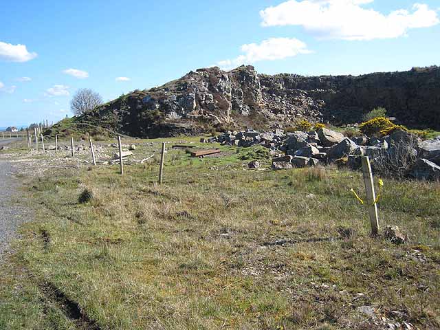 Quarry in BallydalyQuarry · 1711 yd
 Cruachan Aí Heritage CentreMuseum · 1.9 mi
 CastleCastle, unclassified · 2.0 mi
 ToberagullaSpring · 2.4 mi
 European ashEuropean ash · 2.4 mi
 Leitrim CastleCastle, unclassified · 3.5 mi
 Sweet ChestnutSweet Chestnut · 5.7 mi
 Roscommon CastleCastle · 8.3 mi
 FerrinchIslet · 11 mi