What is recorded here
Located on a broad but low N-S ridge. The cropmarks of field boundaries and a road system covering about 25 acres (c. 10 ha) is visible on aerial photographs (MM (5) 30-36; (7) 0-4). Seven ring-ditches, a rectangular enclosure site (WX047-126001-) and a cricular enclosure (WX047-126008-) are also within the field system.
From the National Monuments Service (Archaeological Survey of Ireland) record WX047-126
The monument record does not grant public access. Check the route and ask the landowner before entering private land.
- What survives
- Recorded monument
Places near here
Photo credits
- National Inventory of Architectural Heritage
- Sheila1988, Wikimedia Commons · CC BY-SA 4.0
- Yosemite, Wikimedia Commons · CC BY-SA 3.0
- Jean-Pol GRANDMONT, Wikimedia Commons · CC BY 3.0
- David Hawgood, Wikimedia Commons · CC BY-SA 2.0
- Mike Searle, Wikimedia Commons · CC BY-SA 2.0
- Richard Webb, Geograph · CC BY-SA 2.0
Enclosure in RingaheenEnclosure · 52 ydEnclosure in RingaheenEnclosure · 254 yd farm house1004 ydbridge1362 ydBallyrane Castle (in ruins)Castle, tower house · 1669 ydIrish Agricultural MuseumMuseum · 2.6 miJapanese cedar2.7 miAmerican Sweetgum2.7 miJohnstown CastleCastle · 2.8 mi1798 Memorial PlaqueMemorial · 3.1 miCastle (in ruins)Castle, tower house · 5.1 miForth MountainMountain / peak · 5.4 mi
 farm house1004 yd
 bridge1362 ydBallyrane Castle (in ruins)Castle, tower house · 1669 yd
 Irish Agricultural MuseumMuseum · 2.6 mi
 Japanese cedar2.7 mi
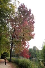 American Sweetgum2.7 mi
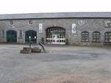 Johnstown CastleCastle · 2.8 mi1798 Memorial PlaqueMemorial · 3.1 mi
_-_geograph.org.uk_-_3715787.jpg/250px-Castles_of_Leinster,_Ballyhealy,_Wexford_(1)_-_geograph.org.uk_-_3715787.jpg "Photo: Mike Searle, Wikimedia Commons · CC BY-SA 2.0") Castle (in ruins)Castle, tower house · 5.1 mi
Castle (in ruins)Castle, tower house · 5.1 mi Forth MountainMountain / peak · 5.4 mi
More archaeology and monuments in County Wexford · All of County Wexford
What do you know about this place?