DDiscover AloneMapAbout

Field system in Phoenixtown

Field system
Computer-made picture that does not show Field system in PhoenixtownNot a photo of this monument
Computer-made picture. It does not show this monument. · Report the wrong picture

The monument record does not grant public access. Check the route and ask the landowner before entering private land.

What do you know about this place?Tap to add a comment or ask a question

What you write will be public.

What is recorded here

Situated on a slight E-facing slope in a gently undulating landscape. An area of intense agricultural processing was first identified in 2004 in centre-line testing (04E0923) on the M3 motorway, and set aside for resolution as Phoenixtown 2 (Keith 2007). A geophysical survey (02R058) highlighted the complexity of the…

Read the whole record
Situated on a slight E-facing slope in a gently undulating landscape. An area of intense agricultural processing was first identified in 2004 in centre-line testing (04E0923) on the M3 motorway, and set aside for resolution as Phoenixtown 2 (Keith 2007). A geophysical survey (02R058) highlighted the complexity of the material (Bartlett 2002), and subsequently a large area (dims c. 100m NW-SE; c. 45m NE-SW) within the way-leave was excavated (E003129) in 2006 and 2007 (Lyne 2010, 2010a). The principal feature revealed was an E-W roadway, together with five corn-drying kilns, a threshing floor, a well and water-hole, and the corner of a house in the immediate vicinity of the road. On ceramic evidence all the features date from the late twelfth to the fourteenth century, but the area was cut by numerous large pits (diam. c. 2-3m; D 0.3-0.9m to dims c. 6-9m x c. 2-3m; D 1m) and many smaller ones which contained a mix of largely local medieval wares, dating generally to the same period. There was very little intrusive material, although prehistoric lithics do occur (ibid. 27-34, 39-48). There were also numerous furrows, generally aligned N-S or E-W that cut through most other features over the area and represent the last activity on the site (ibid. 48-55) but the ceramics recovered date generally to the thirteenth and fourteenth century. The earliest features are some disjointed sections of field boundaries with associated plough furrows (ibid. 5). (Lyne 2008) The name Phoenixtown is derived from the Irish Baile na bhfionnóg – town of the (grey?) crow - which was anglicised as Finnogestown (Murphy 2010, ccxii). The barony of Lower Navan was granted by Hugh de Lacy to Jocelin de Angulo at the start of the Anglo-Norman settlement of Meath in 1172, but there is no record of the initial sub-infeudation. In 1318 the manor of Martry, which was probably as large as the medieval parish, had reverted to the King because its holder, Walter de Say, was guilty of a felony, probably committed during the Bruce campaign (1314-18). Martry was granted to Hugh de Turpelton, but in 1324 possession had passed to Miles de Verdon. An inquisition into the value of Marty at this time mentions Fenokston for the first time, and amongst the free tenants David Beg, Adam Beg, and Richard Lewati hold a carucate of land (c. 300 acres) at Fenokston, and these families were probably the owners of the agricultural enterprise in the excavated area. The ownership of the manor of Martry is uncertain for the rest of the century but by 1415 it had passed to the Darcy family. However, the Beg name recurs in documents through the fourteenth century (ibid. ccix). There are a number of field ditches in the area N of the road which run generally E-W and N-S, although not necessarily connecting with each other. The ditches (Wth 1.3m; D 0.3 to Wth 2.9m; D 2m) form rectangular plots (dims c. 5-20m N-S; 50m plus E-W) and seem to avoid damaging the kilns and the threshing floor. Two parallel ditches placed 5m apart and c. 30m N of the roadway and parallel with it could have been intended as a roadway but the plan was abandoned before it acquired a metalled surface and the metalled road was built instead. (Lyne 2010, 34-39) Compiled by: Michael Moore Date of upload: 11 July 2019

From the National Monuments Service (Archaeological Survey of Ireland) record ME024-027011

Places near here

Photo credits
  • Maker not stated on source page, ca.pinterest.com
  • Maker not stated on source page, www.tripadvisor.ie
  • National Inventory of Architectural Heritage
  • Kmcnamee, Wikimedia Commons · CC BY-SA 4.0
  • Maker not stated on source page, en.wikipedia.org
  • Maker not stated on source page, www.dreamstime.com
  • Jean-Pol GRANDMONT, Wikimedia Commons · CC BY 3.0
  • Garry Dickinson, Wikimedia Commons · CC BY-SA 2.0
  • Maker not stated on source page, www.irishamericanmom.com
  • Maker not stated on source page, commons.wikimedia.org
Church (in Ruins)Church · 1262 yd

Explorer Tom Church in Martry would bring a bottle of wine and a bad attitude to any party. It’s seen better days but still acts…

Holy well in MartryHoly well · 1530 yd

Explorer Tom Martry’s holy well bragged about surviving a storm that didn’t happen, probably to keep people away. It’s sitting in…
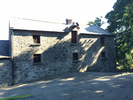
Martry MillMill (water) · 1632 yd

Explorer Tom Martry Mill bragged about surviving a storm that supposedly flattened half of County Meath, though I suspect it just…

St. Ultan's GAA pitchGAA ground · 1.0 miEnclosure in FaughanhillEnclosure · 1.2 mi

Explorer Tom Enclosure in Faughanhill is sitting on top of a hill pretending to be very important, but that ghost inside is too lazy…

Graveyard in Grange (navan Lower By.)Graveyard · 1.3 mi

Explorer Tom Graveyard in Grange sits on a rise like it’s waiting for the rabbits to pay rent. They think the old tombstones are…
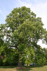
Tuliptree2.0 mi

Explorer Tom Tuliptree in County Meath made a New Year's resolution to stop looking so fancy. It failed spectacularly, of course…

Durhamstown CastleHouse, 16th/17th century · 2.0 mi

Explorer Tom Durhamstown Castle would tell Saint Patrick to stop using him as a wall and find his own way out. It’s a two-storey…

Kilmainham GAA pitchGAA ground · 2.1 miFairy fort / earthen ringfort in ArdbraccanFairy fort / earthen ringfort · 3.4 mi

Explorer Tom Fairy fort / earthen ringfort in Ardbraccan is hiding from its own name, which sounds like a sneeze. It’s built right…

Clongill CastleHouse, 16th/17th century · 3.6 mi

Explorer Tom Clongill Castle has been standing there since the sixteenth century, probably making that weird creaking sound at night…

Fairy fort / earthen ringfort in BoyerstownFairy fort / earthen ringfort · 3.9 mi

Explorer Tom Fairy fort / earthen ringfort in Boyerstown took roughly four billion cups of tea to build this bank properly. The…

More archaeology and monuments in County Meath · All of County Meath

Add to this placeAdd a picture Add a detailed tip Add a story

Explore the map1,095,414 places to discover

Next place · or swipeChurch (in Ruins)