What is recorded here
From the National Monuments Service (Archaeological Survey of Ireland) record DU026-154
Places near here
Photo credits
- Maker not stated on source page, en.wikipedia.org
- Maker not stated on source page, commons.wikimedia.org
- Maker not stated on source page, www.pinterest.com
- Infomatique, Wikimedia Commons · CC BY-SA 4.0
- Raymond Okonski, Geograph · Creative Commons Attribution-ShareAlike 2.0
- Maker not stated on source page, www.dreamstime.com
- Rob Hurson, Wikimedia Commons · CC BY-SA 4.0
- Maker not stated on source page, uk.pinterest.com
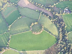 Fairy fort / ringfort in Glebe (rathdown By., Rathmichael Ed)Fairy fort / ringfort · 165 yd
Explorer Tom Fairy fort / ringfort in Glebe claims there’s a hidden tunnel leading straight to the pub, but it only works if you’re…
 CairnCairn, unclassified · 521 yd
Explorer Tom Cairn in Laughanstown has an imaginary fan club of Neolithic people who really loved leaf-shaped arrowheads and hollow…
 CastleCastle, tower house · 531 yd
Explorer Tom Castle in Laughanstown was once home to James Goodman, who acted as Provost Marshall and probably had a fox taking…
 Church (in Ruins)Church · 640 yd
Explorer Tom Church in Laughanstown was a diocesan centre with eight bishops, which sounds like a lot of shouting matches over who…
 Tully GraveyardGraveyard · 640 yd
Explorer Tom Tully Graveyard has a priest who lost a bet there about whether the grass would grow faster on the north side or the…
 Tully Grave YardGraveyard · 644 yd
Explorer Tom Tully graveyard is where a goat once ruled with an iron hoof, demanding tribute in exchange for not eating all the…
 Bullaun stone in RathmichaelBullaun stone · 1114 yd
Explorer Tom Bullaun stone in Rathmichael would survive a zombie attack by just sitting still and letting them think it’s a rock…
 Holed stone in RathmichaelHoled stone · 1120 yd
Explorer Tom Holed stone in Rathmichael was once home to a matchmaker who used the hole as a secret signal for couples to meet in…
 Rathmichael ChurchChurch · 1121 yd
Explorer Tom Rathmichael Church has been lying in ruins for four hundred years, but still hosts a graveyard party. St Michael is…
 Rathmichael GraveyardGraveyard · 1125 yd
Explorer Tom Rathmichael Graveyard in County Dublin is sitting pretty in the sunshine. The locals probably think it's all quiet and…
 Loughlinstown Workhouse CemeteryCemetery · 1203 yd
Explorer Tom Loughlinstown Workhouse Cemetery in County Dublin has an imaginary fan club that meets every Tuesday, mostly to…
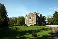 Shankill CastleRuins · 1.0 mi
Explorer Tom Shankill Castle is a ruin that’s been pretending to be a hill for years. It’s in County Dublin, doing its best to blend…
More archaeology and monuments in County Dublin · All of County Dublin

What do you know about this place?Tap to add a comment or ask a question