
Places near here
Photo credits
- Mac McCarron, Geograph · Creative Commons Attribution-ShareAlike 2.0
- Maker not stated on source page, www.pinterest.com
- Maker not stated on source page, www.galwaytourism.ie
- National Inventory of Architectural Heritage
- Claire Loader, heritage.galwaycommunityheritage.org
- Maker not stated on source page, en.wikipedia.org
- Maker not stated on source page, www.churchservices.tv
- dougf, Geograph · CC BY-SA 2.0
 Grave YardGraveyard · 63 yd
Explorer Tom Graveyard in Donaghpatrick is so old that it probably remembers when the river used to flow uphill and the cows were…
 Donaghpatrick CemeteryCemetery · 85 yd
Explorer Tom Donaghpatrick Cemetery in County Galway claims it was best friends with a famous rock star once. They probably just…
 Standing stone in CrossursaStanding stone · 1584 yd
Explorer Tom Standing stone in Crossursa is sitting in low-lying grassland where the water likes to make a mess. It’s got that 'I’m…
 Fairy fort / stone ringfort in GortnaporiaFairy fort / stone ringfort · 1.1 mi
Explorer Tom Fairy fort in Gortnaporia is a collapsed dry stone wall having a full-on drama with the nearest tree for attention. The…
 Church in BallycolganChurch · 1.1 mi
Explorer Tom Church in Ballycolgan has had more names than I've had moods this week, shifting from St Patrick’s to whatever the…
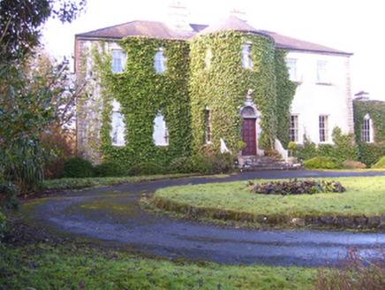 Lisdonagh HouseHouse · 1.2 mi
Explorer Tom Lisdonagh House has bows on both the front and the rear, which is very cheeky. The builder was probably thinking I am a…
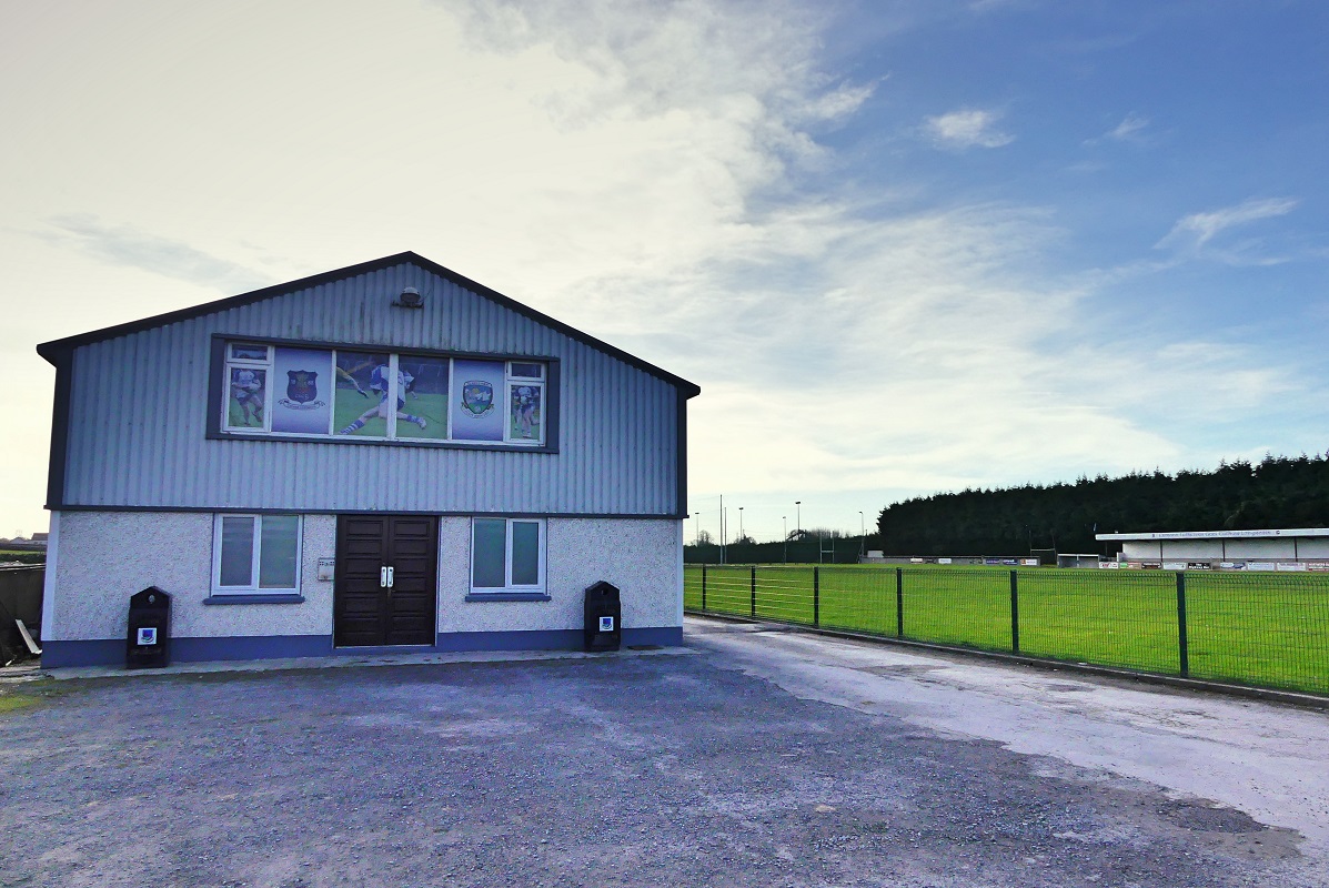 Caherlistrane GAAGAA ground · 1.2 mi
 Standing stone in Bunanraun,liss (clare By.)Standing stone · 1.5 mi
Explorer Tom Standing stone in Bunanraun would order extra ketchup and a small fry at the chipper without blinking. It stands there…
 Fairy fort / earthen ringfort in Cave (clare By.)Fairy fort / earthen ringfort · 1.6 mi
Explorer Tom Fairy fort / earthen ringfort in Cave gave up sugar for Lent but kept the bank on the north side only. It’s poorly…
 Fairy fort / stone ringfort in PollnahalliaFairy fort / stone ringfort · 1.6 mi
Explorer Tom Pollnahallia’s cashel had a bishop who refused to visit because he thought it looked too much like a pile of rocks. The…
 Grange Church (site of)Cemetery · 4.4 mi
Explorer Tom Grange Church in County Galway has a ridiculous smuggling story about people hiding barrels of whiskey behind the…
 Castle (in ruins)Castle, hall-house · 5.6 mi
Explorer Tom Castle in Cargin is a hall-house that had a major makeover in '70. It's basically a 13th-century body in a modern suit.…
More archaeology and monuments in County Galway · All of County Galway

What do you know about this place?Tap to add a comment or ask a question