What is recorded here
Excavations in 2002 undercovered a large field drain which was re-cut as a field boundary. Several fragments of handmade brick were recovered from the stones in the drain suggesting that the feature dated from the period after the destruction of the manor house in 1646 (Myles 2004, 125).
The monument record does not grant public access. Check the route and ask the landowner before entering private land.
- What survives
- Recorded monument
Places near here
 Norman MotteCastle · 124 yd
 Ballymount castleRuins · 144 yd
 RoadRoad, road/trackway · 159 yd
 Ceremonial enclosure in Ballymount GreatCeremonial enclosure · 160 yd
 KilnKiln, lime · 172 yd
 Belgard RoadMemorial · 1384 yd
 Holy well in KilnamanaghHoly well · 1448 yd
 Fitwalk CircuitWalking route · 1.2 mi
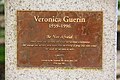 Veronica Guerin memorialMemorial · 1.3 mi
 Mayor's Mile (Finsish)Visitor information · 1.3 mi
 Clondalkin Round TowerHeritage attraction · 1.4 mi
 Tymon Park Yellow SlíWalking route · 1.4 mi