DDiscover AloneMapAbout

Field system in Ardbraccan

Field system
Computer-made picture that does not show Field system in ArdbraccanNot a photo of this monument
Computer-made picture. It does not show this monument. · Report the wrong picture

The monument record does not grant public access. Check the route and ask the landowner before entering private land.

What do you know about this place?Tap to add a comment or ask a question

What you write will be public.

What is recorded here

Situated on a slight S-facing slope and at the N edge of a marshy area. Archaeological testing (04E0584) by N. Fairburn (2004) at Testing Area 11 of Contract 3 of the M3 motorway identified archaeological material (excavations.ie 2004:1158) that was excavated (E003116) by M. Mossop (Mossop et al. 2009) as Ardbraccan 2…

Read the whole record
Situated on a slight S-facing slope and at the N edge of a marshy area. Archaeological testing (04E0584) by N. Fairburn (2004) at Testing Area 11 of Contract 3 of the M3 motorway identified archaeological material (excavations.ie 2004:1158) that was excavated (E003116) by M. Mossop (Mossop et al. 2009) as Ardbraccan 2 (excavations.ie 2006:1487) during May to July 2006 when a fulacht fia, a rath with internal hut-sites, and an external hearth and cereal drying kiln were recorded. Elements of four field systems were also present. Evidence of four field systems were present in the excavated area. The earliest is probably that defined by narrow ditches (Wth 0.74-1.16m; max. D 0.19m) arranged N-S and E-W (yellow on phase plan) that created a rectangular field (dims c. 65m plus E-W; c. 65m N-S). This was replaced by a system (green) that was not directly related to the original layout. A rectangular field (int. dims c. 45m plus N-S; c. 38m E-W) was defined by wide ditches (Wth c. 2.2m; D 0.6m) on three sides that cut the slighter ditches of the earlier system, although it might connect with an E-W ditch from the older system at S where an L-shaped ditch creates a small rectangular enclosure (dims 10m N-S; 9m E-W) with ditches from both systems. The wider ditches are cut by the rath ditch, and a sample of charred ash from one provided a C14 date of 635-774 cal. AD (Beta 247126). (Mossop et al. 2009, 4) Two field systems post-dated the rath. The earlier (mauve) consists of ghost field banks (Wth c. 2m), each with a field drain (max. Wth 1.3m; max. D 0.4m) on either side crossing the excavated area E-W, although the N pair of ditches might be a single ditch (Wth 1.5m; D 0.33m) that bifurcates at its W end. The N pair cut the rath ditch and are cut by the more regular ditches of a post-medieval system. The paired ditches are c. 7-15m apart and may represent an E-W road although no surface was identified, or a narrow plot. The post-medieval system (grey) consists of a drain (Wth 1.8m; D 0.96m) that crosses the excavated area E-W (L c. 68m) and which may be related to the field bank recorded on the 1836 edition of the OS 6-inch map. From this another drain (Wth 1.85m; D 0.98m) extends N (L 48m) almost parallel with the N-S field bank and drain on the 1882 and 1908 editions of the map, although it is not the mapped feature. Some light N-S furrows placed c. 2m apart relate to either of these systems. (Mossop et al. 2009, 7-8) See the attached interpretive plan from Mossop et al. (2009, fig. 18) Compiled by: Michael Moore Date of upload: 25 March 2022

From the National Monuments Service (Archaeological Survey of Ireland) record ME024-041005

Places near here

Photo credits
  • Maker not stated on source page, www.irishamericanmom.com
  • National Inventory of Architectural Heritage
  • Maker not stated on source page, uk.pinterest.com
  • JP, Geograph · CC BY-SA 2.0
  • Maker not stated on source page, www.pinterest.com
  • Dunderry GAA Club (individual photographer not stated), www.dunderrygaa.com
  • Sitomon, Wikimedia Commons · CC BY-SA 2.0
  • Maker not stated on source page, www.tripadvisor.com.ph
  • Mike Searle, Geograph · CC BY-SA 2.0
  • Golfing in Ireland; photographer not stated, Source publisher
Fairy fort / earthen ringfort in ArdbraccanFairy fort / earthen ringfort · 41 yd

Explorer Tom Fairy fort / earthen ringfort in Ardbraccan is hiding from its own name, which sounds like a sneeze. It’s built right…

Fairy fort / earthen ringfort in BoyerstownFairy fort / earthen ringfort · 963 yd

Explorer Tom Fairy fort / earthen ringfort in Boyerstown took roughly four billion cups of tea to build this bank properly. The…
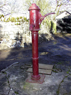
water pump1215 yd

Explorer Tom Water pump in Ardbraccan is being ignored by rabbits who think it’s a fancy bench. It pumped water for centuries and…
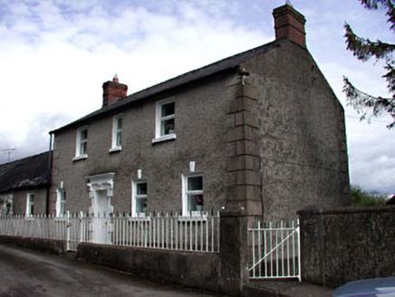
Ardbraccan HouseWorker's house · 1222 yd

Explorer Tom Ardbraccan House in County Meath is a worker’s pad that probably spills secrets after three pints. It stands next to…

Graveyard in LiscartanGraveyard · 1.7 mi

Explorer Tom Graveyard in Liscartan hears everything through its walls, including the river Blackwater humming a tune it’s been…

Liscartan CastleCastle, tower house · 1.7 mi

Explorer Tom Liscartan Castle smells like old money and regret, according to Tom, which is basically the scent profile of every…

Dunderry CemeteryCemetery · 2.7 mi

Explorer Tom Dunderry Cemetery would describe itself to a stranger as 'a place for deep thought and occasional moss growth.' It…

Dunderry GAAGAA ground · 2.9 miEuropean Yew4.8 mi

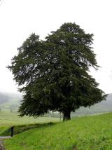
Explorer Tom European Yew in County Meath once saw a farmer drop his lunch and swear for twenty minutes straight. It’s ancient…

St. Bridget's WellSpring · 4.8 mi

Explorer Tom St. Bridget's Well was designed by a mother-in-law who wanted every visitor to feel judged, so it stands there looking…
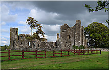
Castle in BectiveCastle, tower house · 4.8 mi

Explorer Tom Castle in Bective is a tower house that would spill its secrets after three pints of stout. It started as a monastery…

Royal Tara Golf ClubGolf course · 5.9 mi

More archaeology and monuments in County Meath · All of County Meath

Add to this placeAdd a picture Add a detailed tip Add a story

Explore the map1,095,414 places to discover

Next place · or swipeFairy fort / earthen ringfort in Ardbraccan