
What is recorded here
From the National Monuments Service (Archaeological Survey of Ireland) record MA100-113002
Places near here
Photo credits
- Maker not stated on source page, au.pinterest.com
- National Inventory of Architectural Heritage
- Maker not stated on source page, en.wikipedia.org
- Maker not stated on source page, www.mayo-ireland.ie
- Maker not stated on source page, ie.pinterest.com
- Maker not stated on source page, www.alamy.com
- Mike Searle, Geograph · CC BY-SA 2.0
- Oliver Dixon, Geograph · CC BY-SA 2.0
- Maker not stated on source page, www.flickr.com
- Maker not stated on source page, uk.pinterest.com
- Mike Searle, Wikimedia Commons · CC BY-SA 2.0
- Willow, Wikimedia Commons · CC BY 2.5
 Hag islandIslet · 515 yd
Explorer Tom Hag Island’s least favourite visitor is anyone who brings a mirror, because they say the Hag hates her own reflection.…
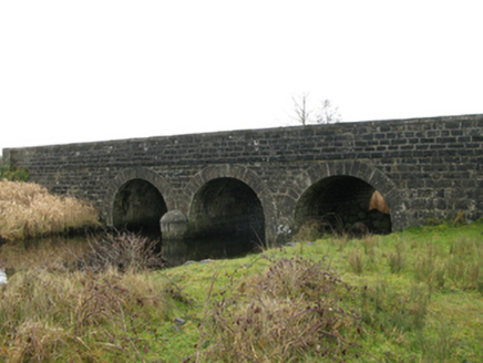 Annies BridgeBridge · 963 yd
Explorer Tom Annies Bridge in Rinaneel was designed by Alexander Nimmo, who clearly liked his arches with a bit of swagger. It’s…
 Church in Carrowkilleen (kilmaine By.)Church · 1410 yd
Explorer Tom Church in Carrowkilleen is so obscure that it was nearly sold as part of a horse deal, which is exactly the kind of…
 Bawn in Castle IslandBawn · 1501 yd
Explorer Tom Bawn in Castle Island gave up meat for Lent back in the day, which is why the walls are so thin. It’s sitting on an…
 Castle IslandIslet · 1511 yd
Explorer Tom Castle Island here was probably built by a guy who thought 'why not just build on a rock?' He likely fell asleep before…
 CemeteryGraveyard · 1534 yd
Explorer Tom Cemetery in Ballycally has the perfect terrain for a zombie apocalypse; just roll over and wait it out. It’s got solid…
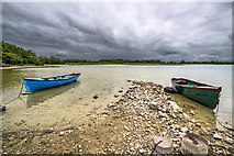 Moore Hall ForestForest · 1.0 mi
Explorer Tom Moore Hall Forest in County Mayo is basically having an identity crisis because it’s next to a lake and thinks it’s one…
 Moore Hall Forest TrailWalking route · 1.1 mi
Explorer Tom Moore Hall Forest Trail is hiding treasure, but don’t get your hopes up, it’s definitely just an old biscuit tin with…
 Cist in Stonepark (carra By., Touaghty Par.)Cist · 1.5 mi
Explorer Tom Cist in Stonepark had a dramatic incident involving a very aggressive goose. The stones were not amused by the…
 Otter IslandCrannog · 1.7 mi
Explorer Tom Otter Island makes a low humming sound at night that sounds like a stone purring in its sleep. It’s basically a lullaby…
 Castle CarraCastle · 2.3 mi
Explorer Tom Castle Carra is where Saint Patrick probably looked around and said, 'This is too much stone for one day' and moved on.…
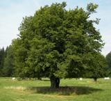 European hornbeam2.3 mi
Explorer Tom European hornbeam once got into a bidding war with a very determined cow who wanted to buy its bark for chewing. The…
More archaeology and monuments in County Mayo · All of County Mayo

What do you know about this place?Tap to add a comment or ask a question