What is recorded here
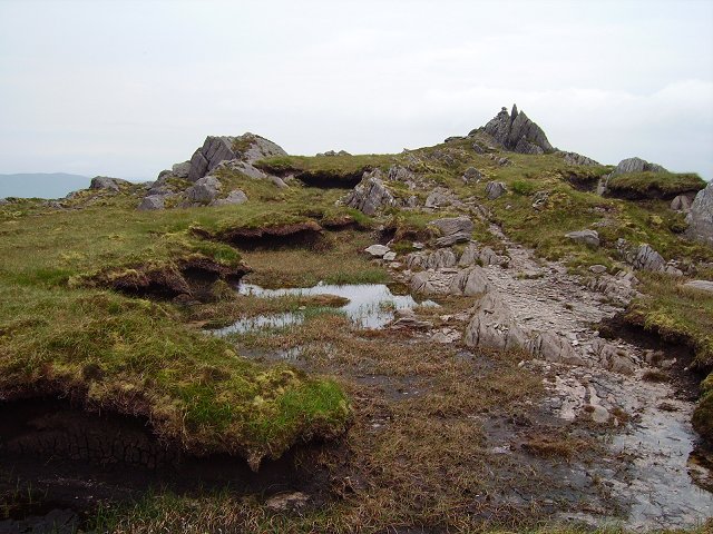
In rough hill pasture, on an uneven area on the NE-facing slope of Knockowen Mountain. A curvilinear stretch (c. 132m) of field wall emerges from the bog at SW and extends to the NE, it then curves to the SE and disappears into bog. At c. 62m from the SW end a linear wall branches off to the SE and continues (L c. 53m) towards a hut site (KE109-048001-). At 16m NE of this hut site a further linear stretch (L 40m) of wall extends to the NE. At its SW tip a branch extends to the SE and continues in this direction for a distance of 44m. In general the field walls (T c. 0.55m; H 0.6m), which protrude above blanket bog, are collapsed and very few continuous stretches occur. Two other hut sites (KE109-048004-, KE109-048006-) are in the immediate vicinity to the SE. There is another hut site (KE109-048007-) 18m to the SE and there is an enclosure (KE109-048005-) in the immediate vicinity to the S.
The above description is derived from the published 'Archaeological Inventory of County Kerry. Volume I: South-West Kerry' (Dublin: Stationery Office, 2009). In certain instances the entries have been revised and updated in the light of recent research.
Date of upload: 30 May 2011
The monument record does not grant public access. Check the route and ask the landowner before entering private land.
- What survives
- Recorded monument
Places near here
 KnockastumpaMountain / peak · 1391 yd
 SheepfoldEnclosure · 1640 yd
 Field system in GlanrastelField system · 1661 yd
 KnockowenMountain / peak · 1.0 mi
 RoadRoad, unclassified togher · 1.1 mi
 Elistragh Br.Bridge · 1.1 mi
 Duck RockIslet · 1.9 mi
 IllaunateeIslet · 1.9 mi
 DroppaCliff · 2.1 mi
 New Zealand broadleafNew Zealand broadleaf · 2.2 mi
 Japanese cedarJapanese cedar · 2.2 mi
 Mare's Tail WaterfallViewpoint · 4.5 mi