What is recorded here
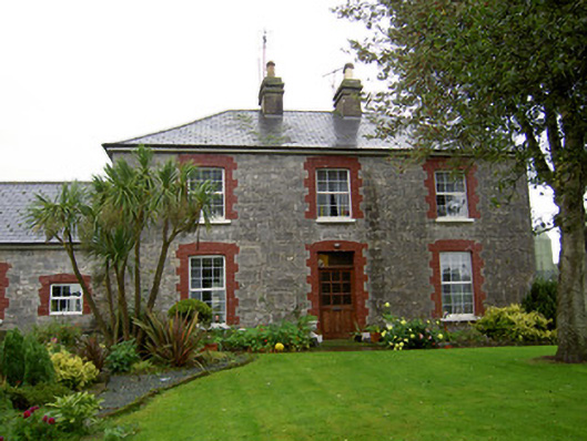
Farmyard complex, built c. 1800, main element being range to west side comprising five-bay two-storey stable block flanked by five-bay single-storey blocks and in turn by three-bay two-storey former steward's house to south and partly ruined multiple-bay two-storey block to north. Five-bay single-storey block attached to house at south end of rear elevation. Recnet extensions to fornt and rear of block to north of house. Slate roofs, hipped to two-storey blocks and to block to east of house, house and stable block having rendered chimneystacks, and north-most single-storey block having brick chimneystack. Snecked roughly dressed limestone walls. Camber-headed openings throughout, with painted brick block-and-start surrounds having replacement uPVC windows with limestone sills. Recent glazed timber door to house, and timber battened doors to outbuildings. Integral segmental carriage arch to south end of stable block, having cast-iron double-leaf gates to west side. Garden to front of house, with rubble limestone boundary wall and square-profile limestone and brick piers with cut limestone caps and single-leaf wrought-iron gate with cut limestone steps. Gateway to yard has square-profile cut limestone piers with plinths, imposts and caps, with decorative cast-iron double-leaf gates. Rubble limestone boundary walls to yard. Well and cast-iron pump to yard.
This Georgian farmyard complex is a fine example of planned farm architecture, complete with former steward's house and stables. The stables comprise a well-proportioned formal block with carriage arch leading to the rear courtyard. High quality materials, such as the limestone walls and brick dressings are used throughout the complex. The steward’s house is distinguished by its form and structure from the other ranges, which housed farm animals and provided accommodation for farm workers. The cut limestone piers are finely executed and retain ornate cast-iron gates. The piers are indicative of the skill of nineteenth-century craftsmanship and enhance the setting of the farmyard.
This does not grant access. Most recorded buildings are privately owned; view them only from public ground unless the owner allows entry.
Places near here
 Killdanave Grave Yard (Site of)Burial ground · 133 yd
 Stone CircleHut site · 829 yd
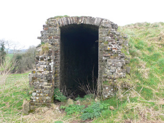 icehouseicehouse · 1115 yd
 Saint Joseph's Catholic Churchchurch/chapel · 1269 yd
 White Knights Tower (Site of)Castle, unclassified · 1.0 mi
 Carriganoura Castle (in Ruins)Castle, tower house · 1.1 mi
 John MandevilleMemorial · 1.6 mi
 Mitchelstown Town MapVisitor information · 1.6 mi
 Statue of Saint FanahanMemorial · 1.7 mi
 Ballyarthur HillMountain / peak · 2.5 mi
 Kilclooney WoodWood · 3.6 mi
 FlagCave · 4.0 mi
Other information
Photo: National Inventory of Architectural Heritage · Website use allowed for educational or private purposes with source credit