Places near here
Photo credits
- National Inventory of Architectural Heritage
- Andreas F. Borchert, Wikimedia Commons · CC BY-SA 4.0
- David Dixon, Geograph · CC BY-SA 2.0
- Kenneth Allen, Wikimedia Commons · CC BY-SA 2.0
- Pampuco, Wikimedia Commons · CC BY-SA 4.0
- P L Chadwick, Wikimedia Commons · CC BY-SA 2.0
- Kenneth Allen, Geograph · CC BY-SA 2.0
- Ronnie Nijboer, Wikimedia Commons · CC0
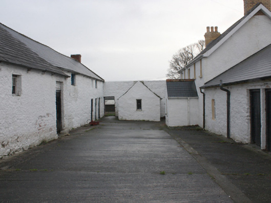
 farm house20 yd
Explorer Tom Farm house in Ballynahone has paired windows with a little colonnette in the middle, which is basically architectural eye contact. It’s got an imaginary twin across the sea that nobody can prove exists, but they’re probably exchanging gossip. Stand back and admire its unique outbuildings without stepping on private turf.
 gates/railings/walls63 yd
Explorer Tom Gates in Ballynahone has a wrought-iron field gate signed J McKenna, set between stone piers with conical caps. Erected around 1870, it keeps the maker's name in view. I came looking for a gateway and found a signature doing the greeting.
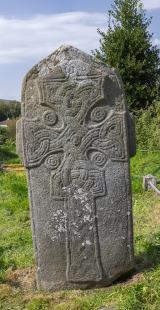 Cross in Glebe (fahan Ed)Cross · 1271 yd
Explorer Tom Cross in Glebe is a slab that’s been arguing with scholars for centuries. It has two figures standing on either side of the cross, and their clothing is covered in inscriptions nobody can properly decipher yet. Add the Greek doxology carved down the edge, and it feels like a puzzle box from another world.
 LisfannonOfficial bathing water · 1.4 mi
Explorer Tom Lisfannon is the sort of beach that changes its stage set with the tide. The Swilly estuary lays out shallow water, sand and mud flats in turn. A 2019 state report notes otters among the wildlife here. I would watch the stage changes from dry ground and let the tide run the show.
 Cashel HillMountain / peak · 1.9 mi
Explorer Tom Cashel Hill in County Donegal makes a low, moaning groan at night that sounds exactly like a ghost who just stubbed its toe on a rock. It’s very dramatic for a hill. Tell it a joke, it's been a long time since anyone did, and it might laugh out loud.
 Inishowen Gateway HotelHotel · 2.4 mi
Explorer Tom Inishowen Gateway Hotel sits in Buncrana, right by the river, acting as a gateway to nowhere specific. It’s a place where confusion is part of the package and the view is all you get. Hang around long enough and you'll hear a story from a local.
 Possible Chambered GravePublicly named tomb or grave · 2.5 mi
Explorer Tom Possible Chambered Grave on Inch Island isn’t even marked on the map, which feels like a secret handshake with history. The name is a bit tentative, but it looks very much like what it says on the tin. I reckon it’s hiding in plain sight, just waiting for someone to nod at it.
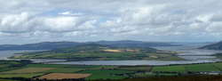 InchIsland · 2.5 mi
Explorer Tom Inch Island is Donegal's trick for people who think an island demands a ferry. The Inch Banks road carries you over Lough Swilly to about thirteen square kilometres of fields, shoreline and old stone. Another Irish name for the place means Island of the Oysters, which is a better lunch suggestion than I usually manage. Look for the remains of a portal tomb near Carnaghan, a fifteenth-century castle above the water and a fort from the early nineteenth century at the northern end. I would tell you I built them all, but even Donegal would spot that lie. Inch Top rises about 222 metres, enough to show how the lough folds around the island. The road is public, while individual ruins and land may have their own access limits; follow signs and do not cross private fields on my authority. Take the causeway slowly. The island begins before you have finished deciding whether you left the mainland.
 Our Lady of Lourdes ChurchCemetery · 2.7 mi
Explorer Tom Our Lady of Lourdes Church has a permanent grudge against the weather for constantly ruining its hairdo. The wind keeps blowing the stained glass out of alignment, and frankly, it needs to stop being so dramatic about it. Toast it with a cup of tea and move on to the next.
 UbiquitousRestaurant · 3.1 mi
Explorer Tom Ubiquitous in Buncrana claims to be everywhere at once, which is either impressive or terrifyingly efficient. I’d check if you’re still yourself when you leave that place. Bring a coin for luck and keep it in your pocket.
 Wych Elm3.2 mi
Explorer Tom Wych Elm in County Donegal is sick of people asking if it's haunted, so I'm asking: has it ever seen a ghost? It just rustled its leaves in a way that said 'please stop asking me about spirits.' Bring a friend who talks too much and let the place shut them up.
 RathmullanOfficial bathing water · 3.2 mi
Explorer Tom Rathmullan Beach starts at the pier and keeps strolling past Kinnegar toward the Glebe outcrop. If sand could wear walking boots, this strip would be lacing them up. A 2019 Lough Swilly report also notes otters among the wildlife; I would leave any real otter sighting to patience and luck.
More historic places in County Donegal · All of County Donegal

What do you know about this place?Tap to add a comment or ask a question