What is recorded here
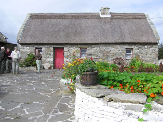
Farm house in Rubble has Turkish reed thatch, which is a grand amount of effort for an address that has already surrendered. ‘Where are you living?’ ‘Rubble.’ ‘Ah, were you insured?’
Detached four-bay single-storey direct entry thatched farmhouse, extant 1895[?], with single-bay single-storey lean-to outshot (north-west). Vacated, 1970. "Restored", 1998, to accommodate alternative use. Pitched roof with part chicken wire-covered replacement Turkish reed thatch on collared timber construction, rope twist above paired exposed stretchers to raised ridge having exposed scallops, repointed chimney stack having stepped capping, and flagged coping to gables. Repointed coursed rubble limestone battered walls originally lime rendered[?] with rough hewn or squared limestone flush quoins to corners. Square-headed window openings with rock faced cut-limestone sills, and rough hewn limestone lintels framing one-over-one timber sash windows having part exposed sash boxes. Square-headed opposing door openings with rough hewn limestone lintels framing timber boarded half-doors. Interior including kitchen retaining hearth with tooled cut-limestone voussoirs centred on tooled cut-limestone keystone, timber boarded opposing door, and timber boarded vaulted ceiling. Set in own grounds.
A farmhouse identified as an integral component of the later nineteenth-century vernacular heritage of County Mayo by such traits as the rectilinear direct entry plan form featuring a characteristic outshot; the construction in unrefined local fieldstone displaying a feint battered silhouette; the somewhat disproportionate bias of solid to void in the massing; and the high pitched roof latterly showing a non-indigenous Turkish reed thatch finish. Furthermore, adjacent outbuildings (extant 1925) continue to contribute positively to the group and setting values of a neat self-contained ensemble making a pleasing visual statement overlooking Creggaballagh Lough.
From the Buildings of Ireland (National Inventory of Architectural Heritage) record 31306104
This does not grant access. Most recorded buildings are privately owned; view them only from public ground unless the owner allows entry.
Places near here
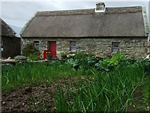 Hennigan's Heritage CentreHeritage attraction · 33 ydCastle (in Ruins)Castle, unclassified · 188 yd
 Hawthorn799 yd
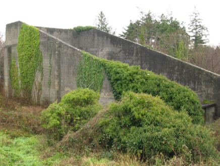 handball alley1.1 mi
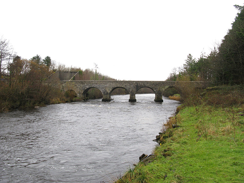 Cloongullaun BridgeBridge · 1.1 miHawthorn1.3 mi
 Grave YardGraveyard · 3.7 mi
 Round Tower3.9 mi
 Ballylahan Castle in RuinsCastle, Anglo-Norman masonry castle · 5.5 mi
 Lough Talt TrailVisitor information · 8.7 mi
 Largan HillMountain / peak · 9.3 mi
 National Museum of Ireland, Country LifeMuseum · 11 mi
Pictures: Pamela Norrington, Geograph · CC BY-SA 2.0; Didier Descouens, Wikimedia Commons · CC BY-SA 4.0; National Inventory of Architectural Heritage; Pamela Norrington, Geograph · Creative Commons Attribution-ShareAlike 2.0; JohnArmagh, Wikimedia Commons · CC BY-SA 3.0; Richard Webb, Geograph · CC BY-SA 2.0; Alan Reid, Geograph · CC BY-SA 2.0; Shanehahaha, Wikimedia Commons · CC BY-SA 3.0
More historic places in County Mayo · All of County Mayo
What do you know about this place?