What is recorded here
Fairy fort in Tisaxon, County Galway: a collapsed ring of earth and stone, thirty-eight metres across, half-swallowed by grass on a south-facing slope. The western bank still stands; the eastern edge has surrendered to footpath and rain. A shallow ditch ghosts along the northern curve, visible only when the light lies flat. People called it a fairy fort because the shape refused explanation, not because fairies were proven. Perhaps a family lived there, raised children, buried their dead, then disappeared into the ordinary world while the hill kept their outline.
On a S-facing slope in undulating grassland. Poorly preserved almost circular rath (N-S 38m, E-W 37m) defined by a collapsed grassed-over bank of earth and stone best preserved at W. Slight traces of an external fosse are visible from NNW through N to NE.
The above description is derived from the published 'Archaeological Inventory of County Galway Vol. II - North Galway'. Compiled by Olive Alcock, Kathy de hÓra and Paul Gosling (Dublin: Stationery Office, 1999).
Date of upload: 05 August 2010
The monument record does not grant public access. Check the route and ask the landowner before entering private land.
- What survives
- Recorded monument
Places near here
 Enclosure in MontpelierEnclosure · 713 yd
 TempleballyReligious house, Franciscan Third Order Regular · 1046 yd
 Ecclesiastical enclosure in Templemoyle (graigabbey Ed)Ecclesiastical enclosure · 1052 yd
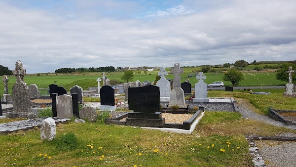 Templemoyle ChurchChurch · 1080 yd
 NewcastleCastle, unclassified · 1.0 mi
 Castle (in ruins)Castle, tower house · 1.8 mi
 First Battle of Athenrybattle · 2.6 mi
 Horse-chestnutHorse-chestnut · 3.1 mi
 Athenry CastleHeritage attraction · 3.2 mi
 Athenry AbbeyHeritage attraction · 3.3 mi
 The HazelWood · 3.3 mi
 Menlough IRAMemorial · 7.9 mi