What is recorded here
Fairy forts hide from modern eyes but resist forgetting. Slieveroe kept its small circle on the western drumlin ridge, visible only through memory and old survey lines. The land may have swallowed the ditch and bank, yet the shape still belongs to the field. People walked past it for generations, feeding it milk or avoiding it at midnight. Forgetting would be an injury, not peace.
Located towards the W end of a short WNW-ESE drumlin ridge. A small enclosure (diam. c. 20-25m) is depicted on the 1834 edition of the OS 6-inch map where it is described in gothic lettering as a ‘fort’. No archaeological feature is visible at ground level in pasture
The above description is derived from the published 'Archaeological Inventory of County Monaghan' (Dublin: Stationery Office, 1986). In certain instances the entries have been revised and updated in the light of recent research.
Compiled by: Michael Moore
Date of revision: 23 February 2018
The monument record does not grant public access. Check the route and ask the landowner before entering private land.
- What survives
- Recorded monument
Places near here
 Grave YardBurial ground · 415 yd
 Trinity Church (Kilmore)church/chapel · 899 yd
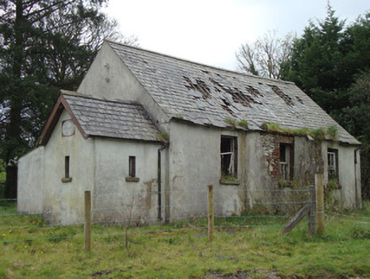 Urcher National Schoolschool · 1045 yd
 Stranoodan fortFairy fort / earthen ringfort · 1570 yd
 Rossmore MausoleumHeritage attraction · 3.2 mi
 Giant Redwood (1862)Heritage attraction · 3.4 mi
 Ballybay Wetland CentreNature reserve · 4.1 mi
 The Rabbit BurrowWood · 4.3 mi
 LisnaspeenanMountain / peak · 5.0 mi
 Fedd HillMountain / peak · 5.4 mi
 Senator Billy Fox 1939 - 1974Memorial · 9.6 mi
 Gull IslandIslet · 12 mi