What is recorded here
Fairy fort in Powerstown, County Cork: a shallow earthen ring, about 30 metres across, on a gentle east-facing slope. The low bank and faint ditch have given way in places, yet the circle still reads as a made shape in the pasture. Nearby, two more ancient marks appear within seventy metres, as if the land kept repeating one idea: surround, enter, remember. People may have lived here, herded here, or simply walked past and called it a fairy fort because the shape refused to explain itself.
In pasture, on gentle E-facing slope. Circular area (30m E-W; 26m N-S) enclosed by low rise (H 0.1m); shallow external fosse (D 0.4m) survives to W and N. Possible entrance to S. Field boundary skirts fosse WSW->N. Second ringfort (CO025-07402-) and moated site (CO025-07401-) c. 70m to NNE and NNW respectively.
The above description is derived from the published 'Archaeological Inventory of County Cork. Volume 4: North Cork' (Dublin: Stationery Office, 2000). In certain instances the entries have been revised and updated in the light of recent research.
Date of upload/revision: 14 January 2009
The monument record does not grant public access. Check the route and ask the landowner before entering private land.
- What survives
- Recorded monument
Places near here
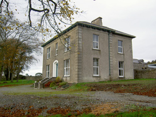 Powerstown Househouse · 515 yd
 Saint Craunacht's Roman Catholic Churchmonument · 743 yd
 IndicatedEnclosure · 1651 yd
 Fulacht fia in Dromdeer WestFulacht fia · 1.3 mi
 Scots PineScots Pine · 2.0 mi
 Pedunculate OakPedunculate Oak · 2.2 mi
 Doneraile Courtornamental canal/lake · 2.3 mi
 Shanballymore Castle (Site of)Castle, unclassified · 3.4 mi
 Anne's Grove GardensHeritage attraction · 3.5 mi
 Ruane Castle (Site of)Castle, unclassified · 4.0 mi
 In loving memory of Elvis O'DonoghueMemorial · 5.9 mi
 Mallow River TrailVisitor information · 6.0 mi