What is recorded here
Mystery Fort appears as a subcircular embanked enclosure in County Monaghan, with a broad oval depression marked by a low ridge. It may have formed when people dug a pit and stacked the removed earth around the edge. The completed shape would have stood out on the flat land, giving a small area of ground a defined edge and a place for activity.
Situated on a low-lying landscape. A subcircular embanked enclosure (ext. dims c. 25m E-W; 30m N-S) described in gothic lettering as a ‘fort’ is depicted at this location on the 1834 edition of the OS 6-inch map and as an oval hachured feature (dims c. 25m N-S; c. 15-20m) on the 1907 edition. This is an overgrown oval area (dims 36m N-S; 30m E-W) with some trees.
The above description is derived from the published 'Archaeological Inventory of County Monaghan' (Dublin: Stationery Office, 1986). In certain instances the entries have been revised and updated in the light of recent research.
Date of revision: 12 December 2017
The monument record does not grant public access. Check the route and ask the landowner before entering private land.
- What survives
- Recorded monument
Places near here
 Man-made underground passage in MomonyMan-made underground passage · 380 yd
 Not indicaetdMan-made underground passage · 408 yd
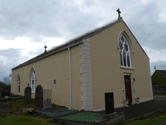 Saint Anne's Catholic Churchchurch/chapel · 1140 yd
 water pumpwater pump · 1221 yd
 Mannan Castle (in ruins)Castle, Anglo-Norman masonry castle · 2.8 mi
 TobernagalliaghSpring · 4.1 mi
 Horse-chestnutHorse-chestnut · 4.4 mi
 KnockreaghMountain / peak · 4.5 mi
 European BeechEuropean Beech · 4.9 mi
 MoatCastle, motte · 5.0 mi
:no_upscale()/cdn.vox-cdn.com/uploads/chorus_asset/file/25593391/County_Louth_6th.jpg) LouthMountain / peak · 5.6 mi
LouthMountain / peak · 5.6 mi Ballsmill Amenity LandPicnic place · 6.9 mi