What is recorded here
Fairy fort / earthen ringfort in Longford Wood is a fairy fort or earthen ringfort in Longford Wood, County Tipperary, Ireland. It occupies a natural rise in undulating pastureland, where a slightly irregular area measuring 30 metres from north to south is bounded by a stony bank 1.5 metres wide. The bank stands 0.3 metres high inside and 0.65 metres high outside, while coniferous plantation covers the northwest sector. Two stone walls cross the denuded site, one running northeast to southwest and the other cutting the northeast quadrant from northwest to southeast.
Situated on a natural rise of ground in undulating pastureland with a possible ringfort (TN023-010) visible c. 100m to the E. The site is denuded and transected by two stone walls, one crossing the site on a NE-SW axis, the other transecting the NE quadrant on a NW-SE axis. A slightly irregular-shaped area (diam. 30m N-S) delimited by a stony bank (Wth 1.5m; int. H 0.3m; ext. H 0.65m) with coniferous plantation in the NW sector. No other features visible.
The above description is derived from 'The Archaeological Inventory of County Tipperary. Vol. 1 - North Tipperary' compiled by Jean Farrelly and Caimin O'Brien (Dublin: Stationery Office, 2002). In certain instances the entries have been revised and updated in the light of recent research.
Date of upload/revision: 22 September 2008
The monument record does not grant public access. Check the route and ask the landowner before entering private land.
- What survives
- Recorded monument
Places near here
 Enclosure in Longford WoodEnclosure · 290 yd
 Hollywell Millmill (water) · 900 yd
 Longford WoodForest · 952 yd
 Holly WellHoly well · 1065 yd
 CastleCastle, ringwork · 1.3 mi
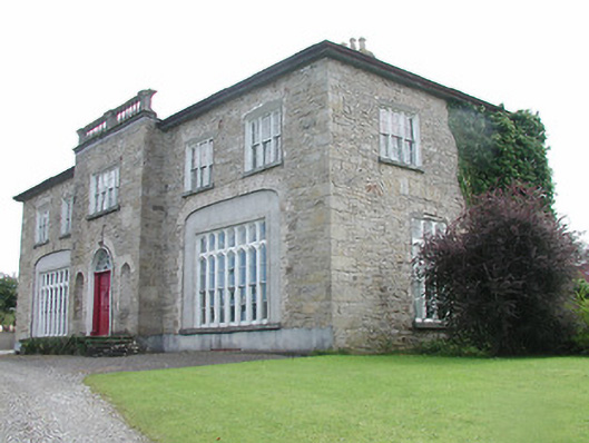 Lisduff Housecountry house · 1.4 mi
 OutlinedCastle, Anglo-Norman masonry castle · 1.5 mi
 BenduffMountain / peak · 2.6 mi
 Borrisnoe MountainMountain / peak · 3.3 mi
 Roscrea Petty Sessions HouseHeritage attraction · 5.8 mi
 Kyleroe WoodWood · 6.0 mi
 Thomas MacDonagh Heritage CentreMuseum · 8.2 mi