What is recorded here
Fairy fort / earthen ringfort in Kilconnell is a fairy fort or earthen ringfort in Kilconnell, County Tipperary, Ireland. It occupies a circular pasture area 28 metres east-west and 27 metres north-south, bounded by a low bank 9 metres wide at its base. The eastern bank narrows to a 5.5-metre-wide scarp that may mark an entrance, while a shallow ditch remains visible to the south-southwest.
In improved, gently undulating pasture, on a slight N-facing slope. Circular area (dims. 28m E-W; 27m N-S) defined by low bank (overall Wth 9m; Wth at top 2-2.5m; int. H 0.35m; ext. H 0.15m) reduced to scarp (Wth 5.5m; H 0.3m; L 6m) at E which may represent an entrance. Remains of fosse (overall Wth 5.55m; basal Wth 1.75m; D 0.1m) S-SW. Interior has a gentle E-facing slope. Field boundary (long-axis N-S) is 10m to W. Ringfort (TS061-104----) is c. 90m to E.
Compiled by: Jean Farrelly
Date of upload: 26 August 2011
The monument record does not grant public access. Check the route and ask the landowner before entering private land.
- What survives
- Recorded monument
Places near here
 Enclosure in KilsallaghEnclosure · 416 yd
 Enclosure in KilconnellEnclosure · 763 yd
 Kilconnell Church (in ruins)Church · 997 yd
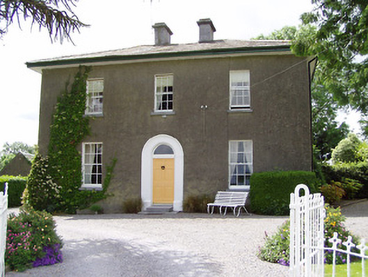 Sandygrove Househouse · 1160 yd
 Bawn in Ballyduagh (railstown Par.)Bawn · 1.2 mi
 Meldrum Castle (ruins)Castle · 1.8 mi
 Ballyknock HillMountain / peak · 3.3 mi
 Cashel Folk MusuemMuseum · 3.6 mi
 Black mulberryBlack mulberry · 3.6 mi
 The Rock Of CashelVisitor information · 3.7 mi
 Cormac's ChapelHeritage attraction · 3.7 mi
 European YewEuropean Yew · 5.4 mi