What is recorded here
Half a meter of earth holds more life than most buildings. Under the fort's skin, forgotten hands still turn soil into shape. The gap between then and now is not empty. It is busy. Memory works through flesh, not through facts. What you call loss, the earth calls continuation.
A subcircular area (dims. c. 38.7m N-S, 37.2m E-W) defined by a low bank from NE-SSE and elsewhere by a scarp (H c. 0.5m - 2m). Possible evidence for fosse from NE-SSE. Original entrance not identifiable.
The above description is derived from the published 'Archaeological Inventory of County Laois' (Dublin Stationery Office, 1995) compiled by P. David Sweetman, Olive Alcock and Bernie Moran. In certain instances the entries have been revised and updated in the light of recent research.
Date of upload: 17 December 2007
The monument record does not grant public access. Check the route and ask the landowner before entering private land.
- What survives
- Recorded monument
Places near here
 IndicatedChurch · 575 yd
 CastleCastle, unclassified · 1132 yd
 Enclosure in Killadooley (detached Portion)Enclosure · 1421 yd
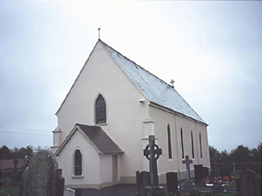 Catholic Church of the Assumptionchurch/chapel · 1462 yd
 Burial Ground (Disused)Church · 1713 yd
 Bawn in Castlefleming Stubber,garrisonBawn · 1.5 mi
 Clonmeen WoodWood · 4.3 mi
 Carricknasrock WoodWood · 4.3 mi
 Black HillMountain / peak · 4.6 mi
 Cnoc SeanrathaMemorial · 6.0 mi
 College HillMountain / peak · 8.9 mi
 DelaneyMemorial · 9.7 mi