What is recorded here
Mature beech and sycamore trees choke the twin earthen banks of Glenastar, hiding a circular fortress that once defied the dark. The outer ridge still stands nearly a metre and a half high, guarding a narrow trench and inner wall that slope gently toward the south-east. Cattle graze the ruined floor beneath the leafy canopy, unaware they trod the same path as forgotten warriors. The fort has surrendered its shape to the forest, yet the heavy soil remembers the hands that built it.
In pasture, on S-facing slope. Circular area (21m N-S; 22m E-W) enclosed by two concentric earthen banks with intervening and outer fosse. Inner bank (int. H 0.7m; ext. H 1.1m) evident all round, apart from short section c. 5m long at SSE where it grades to a scarped edge (H 0.45m; Wth 2m). Outer bank (int. H 1.48m; ext. H 1.5m) also evident all round but is at its lowest (int. H 0.1m; ext. H 1m) at SSE. Intervening fosse (Wth 2.1m) evident SSW->NE, elsewhere banks are separated by flat terrace which widens to c. 4m at SSE. External fosse evident (Wth 1.4m; D 0.3m) W->NNW. Interior used as rough grazing and slopes down towards SSE. Mature beech and sycamore trees cover entire site. Field boundary skirts enclosure at S. A field boundary, which was shown on 1923 OS 6-inch map abutting site at N, has been removed.
Compiled by: Denis Power
Date of upload: 26 August 2011
This remains an important historical record, but the official description says the monument is no longer visible or has been destroyed. The monument record does not grant public access. Check the route and ask the landowner before entering private land.
- What survives
- No visible remains or recorded as destroyed
Places near here
 Enclosure in GlenastarEnclosure · 416 yd
 EnclosureEnclosure, large enclosure · 716 yd
 Dunganville Bridgebridge · 1399 yd
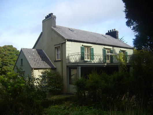 Glenastar Lodgehunting/fishing lodge · 1698 yd
 CahermoyleCastle, unclassified · 2.3 mi
 St. Luke's WellSpring · 2.5 mi
 Castle (in ruins)Castle, tower house · 2.8 mi
 Limerick GreenwayWalking route · 3.2 mi
 St. Kieran's WellSpring · 4.2 mi
 Sugar HillMountain / peak · 4.9 mi
 Lawson's CypressLawson's Cypress · 7.5 mi
 Prospect HillMountain / peak · 7.7 mi