What is recorded here
Fairy fort / earthen ringfort in Garranlea is a fairy fort or earthen ringfort in Garranlea, County Tipperary, Ireland. It occupies a raised sub-oval area in pasture on a southwest-facing slope, measuring about 23 metres north-south and 28 metres east-west. An earthen scarp and bank form the inner boundary, while a very well-defined ditch runs between them and an external bank surrounds the whole site. A causewayed entrance at the east leads into the interior, which slopes gently downward toward the southwest.
In pasture, on a SW-facing slope. Raised sub-oval area (dims. c. 23m N-S; c. 28m E-W) defined by earthen scarp (Wth 6.5m; H 2.6m) NW-N-E-SE and bank (Wth 10m; int. H 0.3m; ext. H 2.9m) SE-S-W-NW. Intervening fosse (Wth 10.4m; D 0.85m) is very well defined all round. External bank (Wth 6.6m; int. H 1.45m; ext. H 0.6m) is modified at WSW, where an oval depression cuts into it and bank is levelled off. Causewayed entrance (Wth c. 5m) at E. Outer bank and inner scarp covered in thorn trees. Interior tends gently downwards to SW; some briars around edge at NW and NE. Ringfort (TS068-080----) c. 270m to NW.
Compiled by: Jean Farrelly
Date of upload: 26 August 2011
The monument record does not grant public access. Check the route and ask the landowner before entering private land.
- What survives
- Recorded monument
Places near here
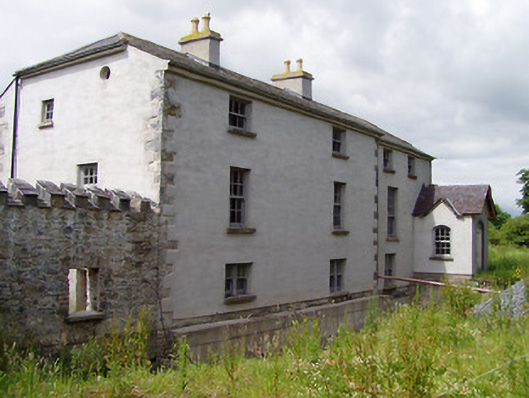 Mill Housemill (water) · 521 yd
 Ecclesiastical enclosure in MasterstownEcclesiastical enclosure · 700 yd
 Bawn in GarranleaBawn · 774 yd
 Garranlea Church (in ruins)Church · 853 yd
 LisheenEnclosure · 1660 yd
 Boytonrath Castle (in ruins)Castle, unclassified · 1.1 mi
 Athassel PrioryHeritage attraction · 3.1 mi
 Caucasian zelkovaCaucasian zelkova · 3.5 mi
 Cappa WoodWood · 4.3 mi
 Caher AbbeyHeritage attraction · 4.7 mi
 Slieveanard NE TopMountain / peak · 4.8 mi
 Siege of Cahir Castlesiege · 4.9 mi