What is recorded here
Fairy fort / earthen ringfort in Galbooly, Shanacloon (Galbooly parish) is a fairy fort or earthen ringfort in Galbooly, Shanacloon (Galbooly parish), County Tipperary, Ireland. The roughly circular enclosure measures 28.4 metres from north-northwest to south-southeast and is bounded by an earth and stone bank 2.2 metres wide. The Poulaneigh River skirts the north and east edges, creating a steep drop to the water, while another stream reaches the southwest edge. Cattle breaks in the bank appear at east-southeast, southeast and north-northwest, each 1.4 metres wide, and dense scrub covers the south half of the site.
Situated at the edge of the Poulaneigh River which skirts the N and E edges of the site. Another stream runs up to the SW edge. A roughly circular area (diam. 28.4m NNW-SSE ) enclosed by an earth and stone bank (Wth 2.2m; int. H 1.08m; ext. H 2.22m) with a steep drop to the river at N and E. There are cattle breaks in the bank at ESE, SE and NNW (Wth 1.4m). The S half of the site is covered in dense scrub.
The above description is derived from 'The Archaeological Inventory of County Tipperary. Vol. 1 - North Tipperary' compiled by Jean Farrelly and Caimin O'Brien (Dublin: Stationery Office, 2002). In certain instances the entries have been revised and updated in the light of recent research.
Date of upload/revision: 22 September 2008
The monument record does not grant public access. Check the route and ask the landowner before entering private land.
- What survives
- Recorded monument
Places near here
 ToberavockyHoly well · 719 yd
 Galbooly Church (in Ruins)Church · 1322 yd
 Bawn in ArcherstownBawn · 1375 yd
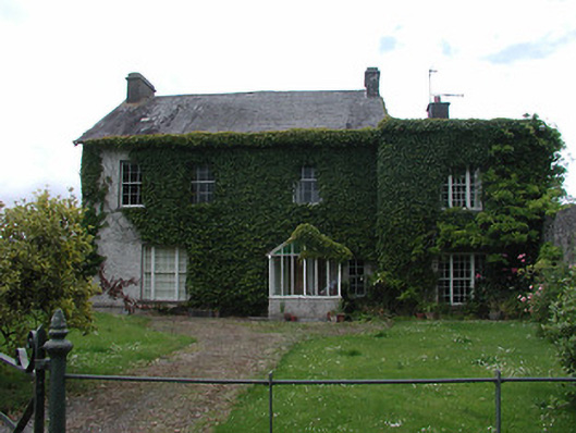 Archerstown Housecountry house · 1383 yd
 Enclosure in Galbooly LittleEnclosure · 1453 yd
 European ashEuropean ash · 1.1 mi
 Byrnes's WoodsForest · 1.2 mi
 CastleCastle, tower house · 1.3 mi
 Lár na PáirceMuseum · 2.4 mi
 Pheasant IslandHeritage attraction · 2.4 mi
 Horse and JockeyVisitor information · 2.8 mi
 Killough Hill (site of)Mountain / peak · 3.7 mi