What is recorded here
Dungooly holds a degraded earthen ringfort with a thirty-six-metre interior, marked by a steepened bank and a narrow southern gap. The fairies never appeared there because human hands had already claimed the land. Their invisible children flew past the boundary, refusing to share a place where mortal life had already grown.
The following description is derived from both the published 'Archaeological Inventory of County Louth' (Dublin: Stationery Office, 1986) and the 'Archaeological Survey of County Louth' (Dublin: Stationery Office, 1991). In certain instances the entries have been revised and updated in the light of recent research.
Date of upload/revision: 17 July 2007
Circular area (int. diam. 36m) enclosed by much-degraded earthen bank (Wth c. 5m, H 1.5m internally, 2m externally), best preserved at SE quadrant but elsewhere eroded down to the level of the interior. The bank has been steepened all the way around, and has a modern drystone wall along its W side. No visible trace of fosse. Probable ancient entrance at SSE, represented by a gap (Wth 2m).
This remains an important historical record, but the official description says the monument is no longer visible or has been destroyed. The monument record does not grant public access. Check the route and ask the landowner before entering private land.
- What survives
- No visible remains or recorded as destroyed
Places near here
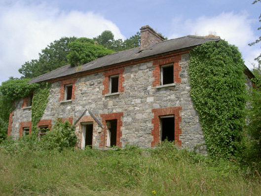 Dungooly Millmiller's house · 638 yd
 Bawn in DungoolyBawn · 671 yd
 Holy well in DrumbillaHoly well · 744 yd
 Dungooly Bridgebridge · 939 yd
 ENCLOSURE in CarriveENCLOSURE · 990 yd
 Ballsmill Amenity LandPicnic place · 1.0 mi
 Sky HillMountain / peak · 1.0 mi
 CroslieveMountain / peak · 1.1 mi
 Forkhill Greenspace PathwayWalking route · 1.1 mi
 Mass Rock Loop TrailWalking route · 1.3 mi
 Ring of Gullion Way - ForkhillVisitor information · 1.3 mi
 Roche CastleCastle, Anglo-Norman masonry castle · 1.8 mi