What is recorded here
Donaghmoyne holds a forty-metre earthen ring on a southeast-facing shelf, its western bank still standing nearly two metres high while the eastern edge has flattened into a shallow scar. The site preserves a broad circular space where human hands shaped soil into a defensible boundary, yet the entrance remains hidden beneath grass and time. Its uneven survival suggests the land itself forgot which parts to keep, leaving a broken circle that still points toward the centre of its own making.
Located just off the crest of a shelf on a SE-facing slope. This is a grass-covered circular area (diam. 40m E-W: 36m N-S) defined by a grass-covered earthen bank that is best preserved (at W: Wth 11m; int. H 1.8m; ext. H 1.4m) SW-WNW but it is reduced largely to a low bank (at E: Wth 10m; int. H 0.3m; ext. H 0.6m) or scarp (at N: Wth 2.8m; H 0.6m; at S: H 1.7m) elsewhere. There are slight traces of a fosse, but the original entrance is not identified.
The above description is derived from the published 'Archaeological Inventory of County Monaghan' (Dublin: Stationery Office, 1986). In certain instances the entries have been revised and updated in the light of recent research.
Date of revision: 11 December 2017
The monument record does not grant public access. Check the route and ask the landowner before entering private land.
- What survives
- Recorded monument
Places near here
 Mannan Castle (in ruins)Castle, Anglo-Norman masonry castle · 300 yd
 Enclosure in DonaghmoyneEnclosure · 383 yd
 IndicatedFairy fort / earthen ringfort · 729 yd
 Donaghmoyne Housegate lodge · 791 yd
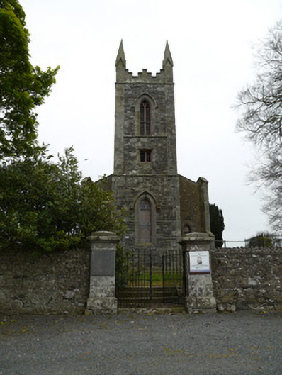 Saint Patrick's Church (Donaghmoyne)church/chapel · 1051 yd
 TobernagalliaghSpring · 1.3 mi
 Horse-chestnutHorse-chestnut · 2.3 mi
 European BeechEuropean Beech · 3.2 mi
 KnockreaghMountain / peak · 3.9 mi
 Fincarn HillMountain / peak · 4.6 mi
 CastleCastle, motte and bailey · 4.7 mi
 Gully IslandIslet · 4.9 mi