What is recorded here
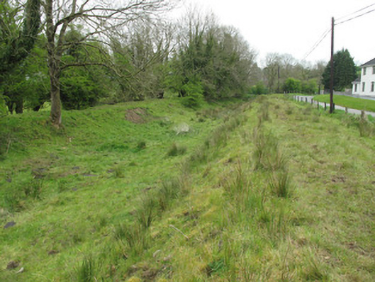
Fairy forts are human places misnamed because people stopped remembering their own history. Coaghen has one of them: an earthen ring on a ridge, partly broken open, still standing at the edge of a road. The fairies did not build it. People did, lived there, left it to rot, and later invented a magical excuse for forgetting.
Situated at the E end of an E-W ridge. It was described in 1968 as an overgrown oval area (dims c. 39m E-W; c. 28m N-S) defined by the remains of an earthen bank (at N: Wth 3.2m; int. H 0.2m; ext. H 3m) with an outer stone facing. There was no visible fosse but it is surrounded by a road E-SW. There was damage or what might have been an entrance (Wth of base 5m) in the perimeter at NE. In 1996 the W part of the monument was removed and the topsoil of the remainder disturbed, so that it is now reduced to a D-shaped grass-covered area (dims 28m N-S; 21m E-W; H 2m).
The above description is derived from the published 'Archaeological Inventory of County Monaghan' (Dublin: Stationery Office, 1986). In certain instances the entries have been revised and updated in the light of recent research.
Revised by: Michael Moore
Date of revision: 29 January 2018
The monument record does not grant public access. Check the route and ask the landowner before entering private land.
- What survives
- Recorded monument
Places near here
 Giants GraveCourt tomb · 450 yd
 CairnCairn, unclassified · 741 yd
 Church in Templetate (dartree By., Clones Par.)Church · 968 yd
 canal (section of)canal (section of) · 1114 yd
 Lisarrilly HillMountain / peak · 1.2 mi
 Roosky Castle (Site of)Castle, ringwork · 1.3 mi
 Jaundice WellSpring · 1.8 mi
 KillycoonaghWood · 3.2 mi
 Common LimeCommon Lime · 3.3 mi
 Rough HillMountain / peak · 3.3 mi
 Saint John's WellSpring · 3.4 mi
 Dagda's CauldronHeritage attraction · 4.5 mi