What is recorded here
Fairy fort / earthen ringfort in Clondalee Beg is a circular grass-covered area at the north edge of a low rise in County Meath, Ireland. Its ditch is seven to nine metres wide across the top and one to six metres wide at the base, with an internal bank barely ten centimetres high along the south-east to south-west edge. The entrance is about four metres wide at the south-east, where bushes still cluster on the inner ditch edge. A person may have stood there in rain or sunlight, watching the land turn above the pit.
Situated at the N edge of a low rise. This is a circular grass-covered area (diam. 20.5m E-W: 18.3mm N-S) defined by a fosse (at N: Wth of top 7.2m; Wth of base 1.5m; int. D 1.9m; ext. D 0.6m; at S: Wth of top 9.3m; Wth of base 6.3m; int. D 0.4m; ext. D 0.2m), with the slight lip of an internal bank (int. H. 0.1m) SE-SW. There are some bushes on the inner edge of the fosse and the entrance (Wth c. 4m) is at SE.
The above description is derived from the published 'Archaeological Inventory of County Meath' (Dublin: Stationery Office, 1987). In certain instances the entries have been revised and updated in the light of recent research.
Compiled by: Michael Moore
Date of revision: 9 August 2019
The monument record does not grant public access. Check the route and ask the landowner before entering private land.
- What survives
- Recorded monument
Places near here
 Enclosure in Newtown or CloneenEnclosure · 1257 yd
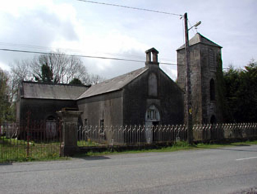 Saint Mary's Catholic Chapelchurch/chapel · 1336 yd
 IndicatedChurch · 1.1 mi
 Abandoned Kinnegad CanalWood · 1.7 mi
 OutlinedFairy fort / ringfort · 2.0 mi
 Donore CastleCastle · 2.3 mi
 European BeechEuropean Beech · 2.7 mi
 CastleCastle, motte · 3.2 mi
 Croppies' GraveMemorial · 3.5 mi
 Cloncurry GraveyardHeritage attraction · 9.8 mi
 Old Bog Road made famous by Teresa Bryton 1868-1943Memorial · 11 mi
 The Grill ShackHeritage attraction · 13 mi