What is recorded here
At the E end of a low NW-SE drumlin ridge. Described in 1995 as a circular grass-covered area with some rushes (diam. 36.2m ENE-WSW; 34.2m NNW-SSE) defined by three earthen banks and two fosses, which were badly overgrown NE-SE and SW-NW. The inner, round-topped bank (Wth 3.7-6.2m; int. H 0.2-0.5m; ext. H 1-1.5m) was reduced to a scarp (H 0.7m) E-S, and was separated by a fosse (Wth of top 5.6-7m; Wth of base 3.3-3.6m) from a central, flat-topped bank (Wth of base 5.6-6.3m; Wth of top 2-3.2m; int.H 0.6-1.4m), which had an entrance (Wth 5m) but no causeways at SE. An outer flat-bottomed fosse (Wth of top 6-6.8m; Wth of base 2.8-3.2m; ext. D 0.4-1.1m) separated the central bank from an outer bank (Wth 3.7-5m; ext. H 0.3m) which only survived ENE-SE and SW-NNW (max. ext. dim. 74m ENE-WSW). Since 1995 part of the central bank as been removed at NE (L 3m) and S (L 10m), and part of the outer bank at NW (L 8m) has also been removed.
Compiled by: Michael Moore
Date of upload: 24 August 2010
The monument record does not grant public access. Check the route and ask the landowner before entering private land.
- What survives
- Recorded monument
Places near here
 IndicatedFairy fort / earthen ringfort · 493 yd
 Embanked enclosureFairy fort / earthen ringfort · 1174 yd
 CastleCastle, unclassified · 1703 yd
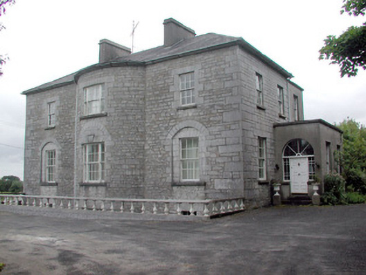 The Gleberectory/glebe/vicarage/curate's house · 1.0 mi
 R. C. ChapelChurch · 1.2 mi
 Common LimeCommon Lime · 1.4 mi
 Strokestown House GardensHeritage attraction · 1.5 mi
 Sweet ChestnutSweet Chestnut · 1.6 mi
 Strokestown ParkHeritage attraction · 1.7 mi
 Slieve BawnMountain / peak · 3.1 mi
 Leitrim CastleCastle, unclassified · 3.5 mi
 Commons North WalkVisitor information · 7.7 mi