What is recorded here
Fairy fort in Ballynakill is a well-preserved earthen ringfort on a steep east-facing slope, its subcircular bank and outer ditch still marking a boundary that people shaped long before modern tools cut through it. The grassland hides rather than erases the work: a living edge, likely residential or defensive, set where Glinsk Castle rises into the distance and an older enclosure waits below. Whatever warnings or wonders attach to fairy forts, this one records human labour, sightlines and survival on land that has kept its shape.
On a steep E-facing slope in grassland. Well-preserved subcircular rath (N-S 40m, E-W 33m) defined by a much-overgrown bank and external fosse; the latter survives from S to W. Numerous breaches in the bank appear modern. An enclosure (GA007-038----) lies to S, and Glinsk Castle (GA007-062001-) is visible to NE.
The above description is derived from the published 'Archaeological Inventory of County Galway Vol. II - North Galway'. Compiled by Olive Alcock, Kathy de hÓra and Paul Gosling (Dublin: Stationery Office, 1999).
Date of upload: 05 August 2010
The monument record does not grant public access. Check the route and ask the landowner before entering private land.
- What survives
- Recorded monument
Places near here
 Enclosure in Ballynakill (ballymoe By.),glinsk (ballymoe By.)Enclosure · 186 yd
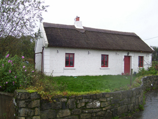 Quigothy Cottagehouse · 351 yd
 Cross in Ballynakill (ballymoe By.)Cross · 367 yd
 Ballinakill AbbeyRuins · 394 yd
_-_geograph.org.uk_-_1952978.jpg?width=1280) Bawn in Glinsk (ballymoe By.)Bawn · 511 yd
Bawn in Glinsk (ballymoe By.)Bawn · 511 yd Site of Killomaine Grave YardArchaeological place · 815 yd
 Site of Ballyglass CastleCastle, unclassified · 3.5 mi
 Rook HillMountain / peak · 4.1 mi
 HawthornHawthorn · 4.3 mi
 Mount MaryMountain / peak · 5.9 mi
 European ashEuropean ash · 6.4 mi
 Sally IslandIslet · 7.2 mi