What is recorded here
Fairy fort / earthen ringfort in Ballymurray is a fairy fort or earthen ringfort in Ballymurray, County Sligo, Ireland. The oval platform sits on a steep-sided hill summit and measures 30.7 metres east-west by 23.5 metres north-south. Two earthen banks surround an intervening fosse, though quarrying and a nearby water reservoir have modified parts of the structure. Blackthorn bushes cover the interior while hawthorn rings the outer bank.
Prominently sited on the summit of a steep-sided hill with excellent views. An oval platform (30.7m E-W; 23.5m N-S) defined by two earthen banks and an intervening fosse. The inner bank (Wth 5.7m; int. H 0.9m; ext. H 1.8m) has a high broadly sloping external face and a low stony internal lip. Some of the stone protruding from the inner edge of the bank may be remains of kerbing or facing. The fosse (Wth 3-4m) and outer bank (Wth 3.5m; int. H 0.5m; ext. H 1.2m) are evident WNW-SW, but there is considerable evidence for recent disturbance and modification. Both appear to have been truncated WSW-WNW by the construction of a water reservoir immediately adjacent to the rath. Areas of quarrying occur within the fosse at NE and SE and more extensively SW-W. The outer bank coincides with the natural break of slope N-S. It is levelled WNW-NE to a broad low flat-topped rise (Wth 8m; int. H 0.4m; ext. H 0.4m) defined on its outer edge by a hawthorn hedgerow. It appears as a compact bank of earth and stone (Wth 3-3.5m; int. H 0.5m; ext. H 0.5-1.2m) ENE-SW, that has been modified to serve as a field boundary. The inner face of the outer bank S-W is greatly disturbed by quarrying. A possible entrance occurs at ESE where there is a slumped gap (Wth 1.4m) in the inner bank and a possible causeway across the fosse as well as a narrow break (Wth 1m), eroded by cattle, in the outer bank. A thicket of blackthorn bushes covers the interior and the outer bank is ringed with hawthorn.
The above description is derived from the published 'Archaeological Inventory of County Sligo' compiled by Ursula Egan, Elizabeth Byrne, Mary Sleeman with Sheila Ronan and Connie Murphy (Dublin Stationery Office, 2005).
Date of upload: 18 January 2008
The monument record does not grant public access. Check the route and ask the landowner before entering private land.
- What survives
- Recorded monument
Places near here
 Enclosure in Rathnarrow (o'hara)Enclosure · 897 yd
 RathnarrowFairy fort / earthen ringfort · 1203 yd
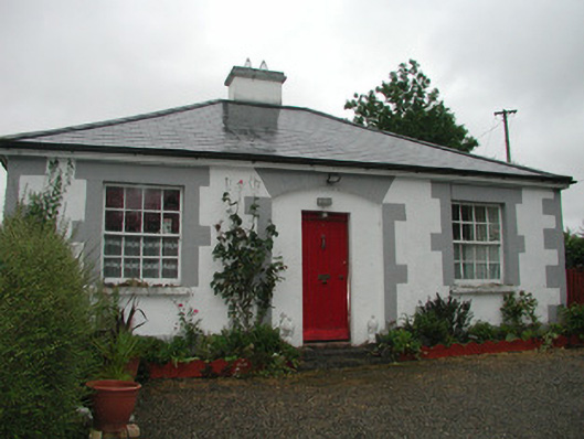 Temple Housegate lodge · 1397 yd
 R. C. ChapelChurch · 1738 yd
 European ashEuropean ash · 1.2 mi
 ElderElder · 1.7 mi
 Moymlough Castle (in Ruins)Castle, tower house · 2.6 mi
 RathdoonyCastle, motte · 3.2 mi
 Tullaghan HillMountain / peak · 3.4 mi
 DoomoreMountain / peak · 4.1 mi
 Brother WalfridMemorial · 4.1 mi
 Teeling MonumentMemorial · 5.3 mi