What is recorded here
No visible road or owner remains, only a thirty-nine metre earthen ring in Ballygirriha pasture, high enough to exclude most cattle and old enough to have been cut through by a later avenue. The lost limekiln and hidden passage suggest the fort was not a display but a working place: fire, water, storage and perhaps underground movement. People may have lived there, buried things there or simply avoided the broken part where the road took its place.
In pasture. Circular area (diam. c. 39m) defined by earthen bank (H 2m); levelled NNE->E; destroyed to SE by line of NE-SW avenue. Limekiln depicted on 1842 OS 6-inch map outside E bank; no visible surface trace. According to Hartnett (1939, 172), 'to the east outside the fort is a spring well'. Man-made underground passage (CO061-043002-) in interior.
The above description is derived from the published 'Archaeological Inventory of County Cork. Volume 3: Mid Cork' (Dublin: Stationery Office, 1997). In certain instances the entries have been revised and updated in the light of recent research.
Date of upload/revision: 14 January 2009
The monument record does not grant public access. Check the route and ask the landowner before entering private land.
- What survives
- Recorded monument
Places near here
 farm housefarm house · 1385 yd
 Lackabane LiosFairy fort / earthen ringfort · 1452 yd
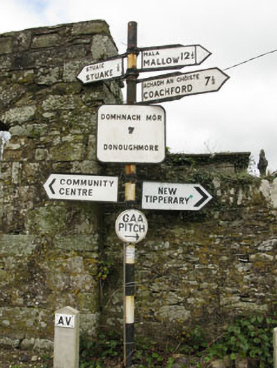 sign postsign post · 1512 yd
 Grave YardGraveyard · 1524 yd
 New TipperaryVisitor information · 1.2 mi
 Saint Bartholomew's WellSpring · 2.1 mi
 Ballyvodane Castle (in Ruins)Castle, unclassified · 2.3 mi
 Oldcastle WoodWood · 2.9 mi
 Carrignamuck Tower HouseCastle · 3.7 mi
 Knockduff Wind FarmVisitor information · 4.2 mi
 Ballyanly Inniscarra Slí na SláinteWalking route · 4.4 mi
 Lyradane MountainMountain / peak · 5.0 mi