What is recorded here
That is a new user request about a visible local landmark. It is not a claim that I remember you, and it does not ask me to hide the source.
In pasture, on gentle W-facing slope. Circular area (22.5m N-S; 22m E-W) defined by scarped edge (H 0.6m; Wth 1.6m) with external fosse (D 0.3m; Wth 4m), both covered by whitethorn bushes. Cattle gaps across scarp at W (Wth 1.5m) and NW (Wth 2m). Some concrete slabs dumped on scarp at NNW. Interior level, dry and clear of overgrowth.
Compiled by: Denis Power
Date of upload: 26 August 2011
See attached ASI aerial photograph ASIAP – 325/3 on 05/10/2002.
A fairy fort / earthen ringfort in Ballinvullin is a circular early-medieval defensive or domestic site, likely dating to between the 5th and 10th centuries AD. Local tradition associates such sites with fairy folk, and they were often avoided due to beliefs in their supernatural inhabitants.
The monument record does not grant public access. Check the route and ask the landowner before entering private land.
- What survives
- Recorded monument
Places near here
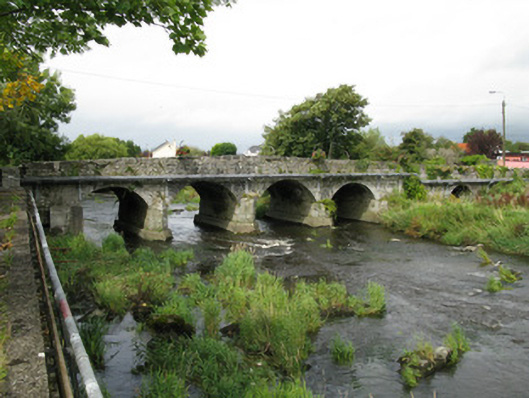 Castlemahon Bridgebridge · 1052 yd
 Corn & Tuck MillWater mill, unclassified · 1055 yd
 Castle MahonCastle · 1424 yd
 Enclosure in Mahoonagh BegEnclosure · 1.1 mi
 EnclosureEnclosure, large enclosure · 1.3 mi
 Templars Castle (in ruins)Castle, Anglo-Norman masonry castle · 2.4 mi
 Saint Ite's WellSpring · 3.6 mi
 Garbally WellSpring · 3.8 mi
 Ballagh MountainMountain / peak · 4.8 mi
 European ashEuropean ash · 5.0 mi
 Limerick GreenwayWalking route · 5.5 mi
 Sugar HillMountain / peak · 6.2 mi