What is recorded here
Fairy forts are earthen ringforts, often small and farm-linked, built and reused across the medieval period. In Ballinruane the circle is about 27m across on a south-facing slope, with a bank, outer ditch and an eastern gap. The interior is level and clear, while bushes hide parts of the edge. It is the kind of place where people may have kept animals, marked ownership or simply made a home visible on the land.
In pasture, on S-facing slope overlooking valley. Circular area (diam. c. 27m) enclosed by earthen bank (int. H 0.45m; ext. H 1.3m) with external fosse (D 0.45m; Wth 3.2m); enclosing element overgrown by bushes. Gap (Wth 3.8m) in bank at E. Field boundary, depicted on 1923 OS 6-inch map abutting enclosure to N, has been removed and fosse partially infilled on this side. Interior level and clear of overgrowth.
Compiled by: Denis Power
Date of upload: 26 August 2011
See attached ASI aerial photograph ASIAP – 323/18 on 05/10/2002.
This remains an important historical record, but the official description says the monument is no longer visible or has been destroyed. The monument record does not grant public access. Check the route and ask the landowner before entering private land.
- What survives
- No visible remains or recorded as destroyed
Places near here
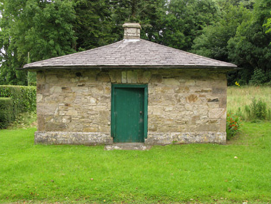 Heathfield Housegate lodge · 855 yd
 IndicatedFairy fort / earthen ringfort · 1356 yd
 Church (in ruins)Church · 1483 yd
 CastleCastle, unclassified · 1513 yd
 BarrowBarrow, ditch barrow · 1.0 mi
 Garbally WellSpring · 1.6 mi
 Mayne Ho.Castle, unclassified · 2.3 mi
 Sunday WellSpring · 2.3 mi
 Famine stoneMemorial · 4.8 mi
 European ashEuropean ash · 5.0 mi
 KnockfeerinaMountain / peak · 5.2 mi
 National Co-op MuseumMuseum · 5.7 mi