What is recorded here
Magic and life are entangled there. Folds and chambers are still visible in the ground. Ards (magunihy By.) is not a decorative story; it is a living record.
In pasture, in a level area, on a gentle S-facing slope. This rath is not visible at ground level. According to the landowner, it was levelled during land reclamation in the 1970s. He recalls a flat area defined by a single bank; he also recalls a Man-made underground passage (KE066-004001-) but is unsure if it was associated with this or with a neighbouring rath (KE066-004----) c. 70m to the NW. Cropmarks of the bank and external fosse of a circular enclosure (diam. c. 30m) are visible in an aerial photograph (GSIAP, V 392-3).
Compiled by: Elizabeth Byrne, Ursula Egan and Sheila Ronan, Archaeological Survey Unit, University College, Cork.
Date of upload: 31 January 2011
The monument record does not grant public access. Check the route and ask the landowner before entering private land.
- What survives
- Recorded monument
Places near here
 Killalee Church (in Ruins)Church · 430 yd
 IndicatedFairy fort / earthen ringfort · 542 yd
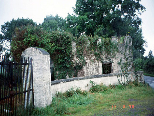 Grenagh Housegate lodge · 926 yd
 Fulacht FianFulacht fia · 1073 yd
 Pallis Castle (Site of)Castle, tower house · 1.2 mi
 CastleCastle, tower house · 1.3 mi
 European YewEuropean Yew · 1.5 mi
 Japanese pagoda treeJapanese pagoda tree · 1.5 mi
 Dunloe Ogham StonesHeritage attraction · 1.7 mi
 Aghadoe Early Medieval Ecclesiastical SiteHeritage attraction · 2.0 mi
 Rabbit or Brown IslandIslet · 2.2 mi
 Lamb IslandIsland · 2.7 mi