What is recorded here
Fairy fort in Ahawilk, County Limerick: a ringfort flattened by ploughs but still traceable under pasture as a shallow circular scar, a narrow fosse and a thin outer bank. It stood atop an east-west ridge when people still drew boundaries around it, and the land later took those boundaries back. What remains is a faint ring in grass, large enough to walk around and small enough to forget until the slope shows its edge.
In pasture, atop E-W ridge. Monument, depicted as embanked circular enclosure (diam. c. 20m) on 1924 OS 6-inch map, has been levelled and surrounding field boundaries removed. However, faint trace of enclosure discernible as circular area (diam. 24m) defined by scarped edge (H 0.15m; Wth 2m) with external fosse (Wth 2.4m) and counterscarp bank (H 0.2m; Wth 5m). Entire site under pasture.
Compiled by: Denis Power
Date of upload: 26 August 2011
The monument record does not grant public access. Check the route and ask the landowner before entering private land.
- What survives
- Recorded monument
Places near here
 Mound in AppletownMound · 958 yd
 TobermurryHoly well · 1634 yd
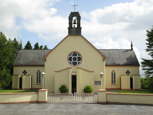 Saint Mary's Catholic Churchchurch/chapel · 1712 yd
 Church in AppletownChurch · 1.0 mi
 Mayne Ho.Castle, unclassified · 2.7 mi
 Castle (in ruins), Springfield CastleCastle, tower house · 2.8 mi
 ToberhoranSpring · 2.8 mi
 Saint Ite's WellSpring · 3.1 mi
 Ballagh MountainMountain / peak · 3.7 mi
 National Co-op MuseumMuseum · 4.9 mi
 Mullaghareirk - Banane LoopWalking route · 5.4 mi
 Rock HillMountain / peak · 6.8 mi