
What is recorded here
Esgair Feithgen is a farmstead in Sir Gaerfyrddin / Carmarthenshire, Wales.
From the Coflein (National Monuments Record of Wales) record 545090
The historic-place record does not grant public access. Check current conditions and ownership before entering land or a building.
Places near here
 Bwlch-y-Rhiw Welsh Independent Chapel, BwlchyrhiwChapel · 1084 yd
 Cwm-yr-OlchfaBank (earthwork) · 1257 yd
 Tomen-y-RhosRound Barrow · 1569 yd
 Mynydd MyddfaiMountain / peak · 1672 yd
 Black CockTrackway · 1.3 mi
 Y PigwnMountain / peak · 1.7 mi
 Forest north of Usk reservoirForest or wood · 1.8 mi
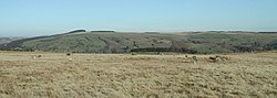 Trecastle Mountain Eastern CircleMountain or hill · 2.0 mi
 Usk reservoir with Black Mountain peaksMountain or hill · 2.0 mi
 Forest Carpark south of Usk ReservoirForest or wood · 2.7 mi
 Llandovery CastleCastle · 2.8 mi
 Lewis Memorial FountainMemorial · 2.9 mi
Pictures: Philip Halling, Wikimedia Commons · CC BY-SA 2.0; Alan Bowring, Wikimedia Commons · CC BY-SA 2.0; Alan Richards, Wikimedia Commons · CC BY-SA 2.0; Nigel Davies, Wikimedia Commons · CC BY-SA 2.0; Dave Farmer, Wikimedia Commons · CC BY-SA 2.0; Andrew Hill, Wikimedia Commons · CC BY-SA 2.0; Rob Purvis, Wikimedia Commons · CC BY-SA 2.0; Jaggery, Wikimedia Commons · CC BY-SA 2.0
More historic places in Sir Gaerfyrddin / Carmarthenshire · All of Sir Gaerfyrddin / Carmarthenshire
What do you know about this place?