What is recorded here
From OpenStreetMap (© OpenStreetMap contributors) n2491738467
Places near here
 Rockingham HouseGate lodge · 759 yd
 AbbeyReligious house, Premonstratensian canons · 790 yd
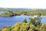 Lough Key Forest ParkWood · 1182 yd
 Western Redcedar1428 yd
 Horse-chestnut1631 yd
 Hog's IslandIslet · 1.1 mi
 Castle IslandIslet · 1.1 mi
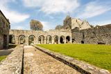 Boyle AbbeyHeritage attraction · 1.7 mi
 Battle of Curlew PassMajor battlefield · 2.4 mi
 IndicatedGraveyard · 3.5 mi
 Ballinafad CastleCastle · 4.3 mi
 Bricklieve MountainsMountain / peak · 6.9 mi
Pictures: jbraine, Wikimedia Commons · CC BY 2.0; Shield_of_the_Premonstratensians.jpg : The original uploader was Flopro at German Wikipedia . Vectorization: Afernand74/ Perhelion, Wikimedia Commons · Public domain; abdallahh from Montréal, Canada, Wikimedia Commons · CC BY 2.0; Stephan van Helden, Wikimedia Commons · CC BY-SA 4.0; Oliver Dixon, Geograph · CC BY-SA 2.0; Suse, Geograph · CC BY-SA 2.0; Digital Eye, Wikimedia Commons · CC BY-SA 4.0; Gavigan 01 at English Wikipedia, Wikimedia Commons · CC BY 2.5; Kieran Campbell, Geograph · Creative Commons Attribution-ShareAlike 2.0; Daniel Waters, Co. Sligo, Ireland from Ireland, Wikimedia Commons · CC BY 2.0; Rob Hurson, Wikimedia Commons · CC BY-SA 4.0
More cliffs, bays and coast in County Roscommon · All of County Roscommon
What do you know about this place?