DDiscover AloneMapAbout

Erect Stones

Standing stone
Erect Stones
Representative picture, exact place not confirmed
Photo: Maker not stated on source page, au.pinterest.com · Report the wrong picture

This remains an important historical record, but the official description says the monument is no longer visible or has been destroyed. The monument record does not grant public access. Check the route and ask the landowner before entering private land.

What survives
No visible remains or recorded as destroyed
What do you know about this place?Tap to add a comment or ask a question

What you write will be public.

What is recorded here

There is no trace of the 'erect stones' marked on the 1st edition of the OS 6-inch map. Situated on rough ground sloping SW towards Lough Swilly. Excavation licence number 00E0646 A one-day site assessment was carried out in the area of a proposed house site at Liafin, Linsfort, Co. Donegal, in order to fulfil the…

Read the whole record
There is no trace of the 'erect stones' marked on the 1st edition of the OS 6-inch map. Situated on rough ground sloping SW towards Lough Swilly. Excavation licence number 00E0646 A one-day site assessment was carried out in the area of a proposed house site at Liafin, Linsfort, Co. Donegal, in order to fulfil the requirements of an outline planning application to erect a dwelling and septic tank. The archaeological site that prompted this assessment, standing stone SMR 19:15, no longer appears to exist at its recorded location. However, two 'new' standing stones had been located in the field on the opposite side of the road to the development site during a previous site assessment. Three test-trenches were opened within the area of development—Trenches 1 and 2 within the footings of the building, and Trench 3 along the length of the proposed access road to the dwelling. Trench 1 was placed along the length of the proposed building and was located 26m from the west field boundary and 8m from the north field boundary. The trench, which was 20m long, c. 2m wide and orientated north-south, was excavated with the aid of a machine fitted with a toothless bucket. The topsoil (a grey/dark brown, loamy, silty clay that ranged in depth from 0.2m to 0.26m) was removed to uncover the underlying subsoil—an orange/white, soft, sandy, silt boulder clay. No archaeological activity was located during this work. Trench 2 was placed along the width of the proposed building, at right angles to Trench 1, approximately central to the first trench. This trench was c. 2m wide and 10m long. Again the topsoil was stripped to uncover the underlying subsoil. No archaeological activity was uncovered within this trench. Trench 3 was placed along the length of the proposed access road to the dwelling and was located c. 8m to the south of Trench 2 and 13m to the west of Trench 1. The area opened up was c. 2m wide and 15m long. Again the topsoil was removed to uncover the underlying subsoil, and nothing of archaeological significance was located within this trench. (Excavations Bulletin 2000) Ciara McManus, ADS, Unit 48, Westlink Enterprise Centre, 30-50 Distillery Street, Belfast. Pre-development testing was undertaken by Aaron Johnston, for Archaeological Development Services Ltd, under licence No. 08E0543 across the site proposed for the construction of a dwelling house with wastewater treatment plant and access road. The site of development is located partly within the constraint rings of a megalithic tomb (DG019–014----) and a standing stone (DG019–015----). A desk-based assessment undertaken in 2000 concluded that the standing stone was no longer in situ. However, two previously unrecorded standing stones located a short distance across the road to the south-west are likely to be the remains of this monument. A test excavation conducted later in the same year by Ciara MacManus (ADS) revealed no archaeological features or artefacts within the site proposed for construction of the house (Excavations 2000, No. 184, 00E0646). The plan of development was amended several years later which involved relocating the proposed dwelling house a short distance to the north of the site planned initially. The relocation of the proposed dwelling house was therefore subject to a planning condition by Donegal County Council to carry out a further phase of testing. This was carried out on 14 August 2008. Four transecting trenches were excavated, which measured between 25–60m in length. They were excavated across the site of the proposed house, septic tank and driveway. No archaeological features or artefacts of any kind were exposed during testing. The above description was derived from the 'Archaeological Survey of County Donegal. A description of the field antiquities of the County from the Mesolithic Period to the 17th century.' Compiled by: Brian Lacey with Eamon Cody, Claire Cotter, Judy Cuppage, Noel Dunne, Vincent Hurley, Celie O'Rahilly, Paul Walsh and Seán Ó Nualláin (Lifford: Donegal County Council, 1983).

From the National Monuments Service (Archaeological Survey of Ireland) record DG019-015

Places near here

Photo credits
  • Maker not stated on source page, uk.pinterest.com
  • Maker not stated on source page, www.pinterest.com
  • National Inventory of Architectural Heritage
  • Maker not stated on source page, ru.pinterest.com
  • Maker not stated on source page, en.wikipedia.org
  • Maker not stated on source page, tr.pinterest.com
  • Maker not stated on source page, www.dreamstime.com
Megalithic structure in LiafinMegalithic structure · 72 yd

Explorer Tom Megalithic structure in Liafin includes two large stones beside a road, partly hidden by a thick hedge when described.…

Giants Beds Court TombCourt tomb · 302 yd

Explorer Tom Giants Beds Court Tomb sits on a boggy ridge in Liafin, staring straight at Lough Swilly. Back in the mid-1840s, it was…

Standing stone in Glebe (desertegny Ed)Standing stone · 953 yd

Explorer Tom Standing stone in Glebe is exactly 2.04m high, which is basically the height of a tall person standing on tiptoes. I…

Standing stone in BallyannanStanding stone · 963 yd

Explorer Tom Standing stone in Ballyannan is a hefty slab measuring 2.8m by 1.2m, lying on open mountain terrain rising to the…
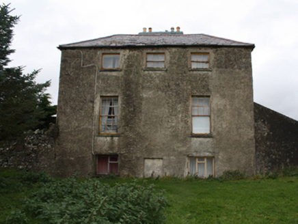
Glebe HouseRectory/glebe/vicarage/curate's house · 984 yd

Explorer Tom Glebe House sits by Lough Swilly, described as a neat whitewashed building costing about £3,000. I bet Revd. Hervey…

Standing StonesStanding stone · 1180 yd

Explorer Tom Ballyannan's two leaning standing stones may be only one part of the puzzle. Traces of buried stone continue roughly…
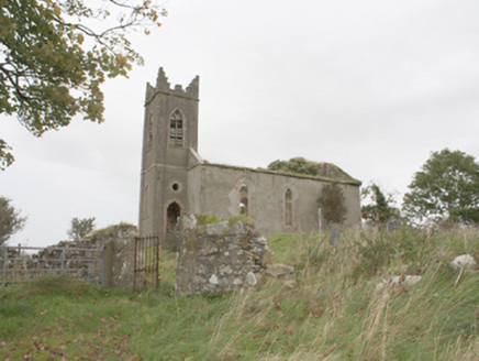
Desertegny Church of Ireland ChurchChurch/chapel · 1215 yd

Explorer Tom Desertegny Church of Ireland Church was built in 1779, while the tower’s round window bears the dates 1666 and 1884. I…

Meenalooban Cairn near the Old ChurchCairn, unclassified · 1348 yd

Explorer Tom Meenalooban Cairn near the Old Church is officially recorded, which is brilliant, but we have absolutely no clue what…

Megalithic structure in LinsfortMegalithic structure · 1363 yd

Explorer Tom Megalithic structure in Linsfort is incredibly proud of the fact that nobody knows where its main slab went after 1773…
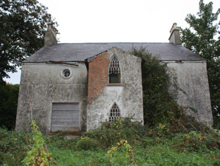
Linsfort CottageHouse · 1364 yd

Explorer Tom Linsfort Cottage has round upstairs windows that look ready to ask a question. Built around 1840, it also has pointed…
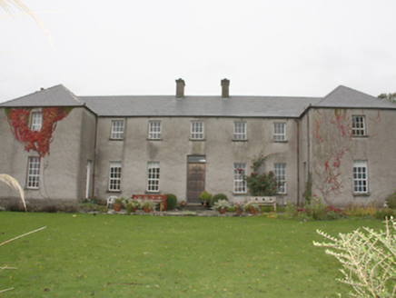
Linsfort CastleCountry house · 1368 yd

Explorer Tom Linsfort Castle is actually a house from 1720 built by Captain Arthur Benson, so don’t be fooled by the name. The…

Greenhill GraveyardGraveyard · 1702 yd

Explorer Tom Greenhill Graveyard has a curved wall that might follow an older enclosure, though the survey keeps that as a…

More archaeology and monuments in County Donegal · All of County Donegal

Add to this placeAdd a picture Add a detailed tip Add a story

Explore the map1,095,414 places to discover

Next place · or swipeMegalithic structure in Liafin