What is recorded here
Located on a S-facing slope. A D-shaped area (dims c. 45m WNW-ESE; c. 35m NNE-SSW) defined by the cropmark of a fosse is visible only on iMAPs (2022). It is overlaid by a NNW-SSE field bank towards the edge at W, and it was first reported by Jean Charles Caillére. See the attached enhanced view from iMAPs (2022)
Compiled by: Michael Moore
Date of upload: 6 June 2023
From the National Monuments Service (Archaeological Survey of Ireland) record WX034-103
The monument record does not grant public access. Check the route and ask the landowner before entering private land.
- What survives
- Recorded monument
Places near here
_-_geograph.org.uk_-_7608906.jpg/250px-Castles_of_Leinster,_Tellarought,_Wexford_(1)_-_geograph.org.uk_-_7608906.jpg "Photo: Mike Searle, Wikimedia Commons · CC BY-SA 2.0") Castle (in ruins)Castle, tower house · 833 ydLady WellHoly well · 848 ydsite of CastleCastle, unclassified · 1659 yd
Castle (in ruins)Castle, tower house · 833 ydLady WellHoly well · 848 ydsite of CastleCastle, unclassified · 1659 yd kiln1.1 mi
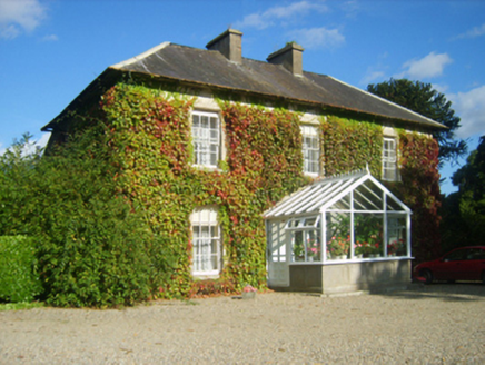 Hillview HouseFarm house · 1.2 mi
 SlievecoiltiaMountain / peak · 1.6 miThe Croppy GroveMemorial · 1.9 miGarden of RemembranceMemorial · 1.9 mi
 Devon whitebeam2.2 mi
 Lacken HillMountain / peak · 3.7 mi
 1798 MonumentMonument · 3.7 mi
 Forest Of The DunbrodyForest · 4.0 mi
Pictures: Mike Searle, Wikimedia Commons · CC BY-SA 2.0; National Inventory of Architectural Heritage; David Purchase, Wikimedia Commons · CC BY-SA 2.0; seegraswiese, Wikimedia Commons · CC BY-SA 3.0; Hywel Williams, Geograph · CC BY-SA 2.0; Ryanforsyth9, Wikimedia Commons · CC BY-SA 4.0
More archaeology and monuments in County Wexford · All of County Wexford
What do you know about this place?