What is recorded here
Situated on a gentle SE-facing slope down to the Claureen River c. 250m to the SE. Hachured as a circular enclosure (diam. c. 35m) on the 1842 ed. of the OS 6-inch map and as a circular feature (diam. c. 25m) on the 1921 ed. Described as a cashel with a portion of wall (H c. 2m) at W (Ua Cróinín survey 1988, SMR file). On inspection in 2000 it was not visible at ground level.
From the National Monuments Service (Archaeological Survey of Ireland) record CL033-078
The monument record does not grant public access. Check the route and ask the landowner before entering private land.
- What survives
- Recorded monument
Places near here
Photo credits
- National Inventory of Architectural Heritage
- Yankiv121, Wikimedia Commons · CC BY-SA 4.0
- C O'Flanagan, Wikimedia Commons · CC BY-SA 2.0
- Andreas F. Borchert, Wikimedia Commons · CC BY-SA 4.0
- Graham Horn, Geograph · CC BY-SA 2.0
IndicatedFairy fort / stone ringfort · 1076 yd Cahircalla HouseCountry house · 1440 ydClaureen BridgeBridge · 1601 ydPoul na gollorCave · 1.1 miPost Office FieldNature reserve · 1.2 miCastleCastle, tower house · 1.4 miO'Connell ColumnMonument · 1.4 miClare MuseumMuseum · 1.4 miEnnis AbbeyMuseum · 1.4 miAlice and Gwendoline CaveMuseum · 1.7 miRockmount WoodWood · 1.8 miShallee Castle (in Ruins)Castle, tower house · 2.2 mi
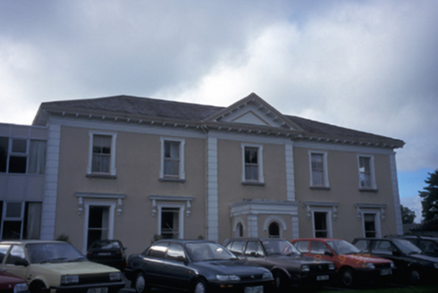 Cahircalla HouseCountry house · 1440 yd
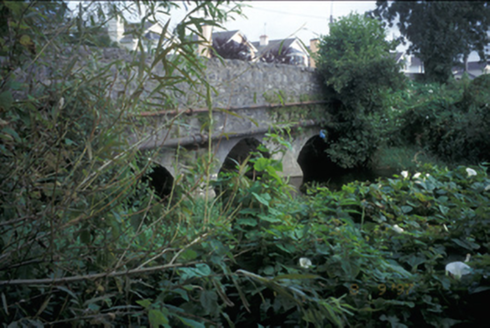 Claureen BridgeBridge · 1601 ydPoul na gollorCave · 1.1 miPost Office FieldNature reserve · 1.2 miCastleCastle, tower house · 1.4 mi
 O'Connell ColumnMonument · 1.4 mi
 Clare MuseumMuseum · 1.4 mi
 Ennis AbbeyMuseum · 1.4 miAlice and Gwendoline CaveMuseum · 1.7 miRockmount WoodWood · 1.8 mi
 Shallee Castle (in Ruins)Castle, tower house · 2.2 mi
More archaeology and monuments in County Clare · All of County Clare
What do you know about this place?