What is recorded here
Situated in gently undulating pasture 100m to N of foreshore at W end of Rosses Point. There are excellent views over Oyster Island, Coney Island and the mouth of Sligo Harbour. This enclosure is not depicted on any edition of the OS 6-inch map, but is recorded on an aerial photograph (OS 3 0337-8, roll 158, pr. 24). A field inspection in 1994 found that the enclosure had been leveled, but a faint outline could still be traced. It consisted of a circular area (diam. 9.5m N−S) defined by a fosse, evident as a shallow depression (Wth 2-2.3m; D 0.2m). Outside the fosse, an outer bank could be traced at NE−W as a very low rise (Wth c. 2m; int. H 0.2m; ext. H 0.1m). The overall diameter from mid bank to mid bank was 16m N−S. The interior sloped gently down from N to S. When inspected in 2004, there was no visible surface trace at ground level. O'Donovan
Date of upload: 21 April 2011
Situated in gently undulating pasture 100m to N of foreshore at W end of Rosses Point. There are excellent views over Oyster Island, Coney Island and the mouth of Sligo Harbour. This enclosure is not depicted on any edition of the OS 6-inch map, but is recorded on an aerial photograph (OS 3 0337-8, roll 158, pr. 24). A field inspection in 1994 found that the enclosure had been leveled, but a faint outline could…
From the National Monuments Service (Archaeological Survey of Ireland) record SL008-174
The monument record does not grant public access. Check the route and ask the landowner before entering private land.
- What survives
- Recorded monument
Places near here
 Elsinore HouseHouse · 86 yd
 Waiting on ShoreMemorial · 141 yd
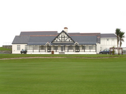 County Sligo Golf ClubClubhouse · 254 yd
 Rosses Point BeachBeach / strand · 408 yd
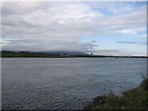 Oyster IslandIslet · 561 ydEnclosure in Oyster IslandEnclosure · 649 ydBastioned fort in Inishmulclohy or Coney IslandBastioned fort · 911 yd
 Rosses Point BeachBeach / strand · 1123 yd
 Coney IslandIsland · 1.0 miDrumcliff BayBay · 1.4 miDoonanpatrick IslandIslet · 1.4 mi
 Graveyard in KillaspugbroneGraveyard · 2.1 mi
Pictures: Colin Park, Geograph · Creative Commons Attribution-ShareAlike 2.0; Colin Park, Geograph · CC BY-SA 2.0; National Inventory of Architectural Heritage; Willie Duffin, Geograph · CC BY-SA 2.0; Bob Embleton, Geograph · CC BY-SA 2.0; Pampuco, Wikimedia Commons · CC BY-SA 4.0
More archaeology and monuments in County Sligo · All of County Sligo
What do you know about this place?