What is recorded here
In generally level, lush pasture. Reported to the Archaeological Survey of Ireland as the cropmark of an enclosure. Slight, low profile oval rise, best defined S->W->N by barely traceable remains of levelled scarp (Wth c. 6m; H 0.15m). Linear scarp (long axis c. E-W) is adjacent to N. Oval cropmark is evident on aerial photography which appears to correspond with the oval rise recorded at ground level during the field inspection.
In generally level, lush pasture. Reported to the Archaeological Survey of Ireland as the cropmark of an enclosure. Slight, low profile oval rise, best defined S->W->N by barely traceable remains of levelled scarp (Wth c. 6m; H 0.15m). Linear scarp (long axis c. E-W) is adjacent to N. Oval cropmark is evident on aerial photography which appears to correspond with the oval rise recorded at ground level during the…
From the National Monuments Service (Archaeological Survey of Ireland) record KE066-153
The monument record does not grant public access. Check the route and ask the landowner before entering private land.
- What survives
- Recorded monument
Places near here
Photo credits
- Mike Searle, Geograph · CC BY-SA 2.0
- Berthold Strucken, Wikimedia Commons · CC BY-SA 4.0
- Bkwillwm, Wikimedia Commons · CC BY-SA 3.0
- National Inventory of Architectural Heritage
- Adrian Beney, Wikimedia Commons · CC BY-SA 2.0
- Colin Park, Geograph · CC BY-SA 2.0
- Mike Murphy ( talk · contribs ), Wikimedia Commons · CC BY-SA 3.0
- Keith Salvesen, Geograph · CC BY-SA 2.0
- Humphrey Bolton, Geograph · CC BY-SA 2.0
- A.-K. D., Wikimedia Commons · CC0
- Sitomon, Wikimedia Commons · CC BY-SA 2.0
 Aghadoe Church (in Ruins)Church · 629 yd
_1.jpg/250px-Aghadoe_(Early_Medieval_Ecclesiastical_Site)_1.jpg "Photo: Berthold Strucken, Wikimedia Commons · CC BY-SA 4.0") Aghadoe Early Medieval Ecclesiastical SiteHeritage attraction · 654 yd
Aghadoe Early Medieval Ecclesiastical SiteHeritage attraction · 654 yd Parkavonear CastleCastle · 680 yd
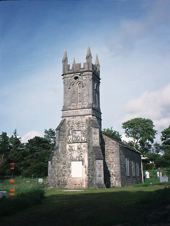 Aghadoe ChurchChurch/chapel · 1062 yd
 Lamb IslandIsland · 1.9 mi
 Circular WalkWalking route · 1.9 mi
 Giant Sequoia2.3 mi
 Innisfallen Abbey (in Ruins)Ecclesiastical site · 2.3 mi
 River WalkWalking route · 2.3 mi
 Cross-slab in InnisfallenCross-slab · 2.3 mi
 European Yew2.3 mi
 InnisfallenIsland · 2.4 mi
More archaeology and monuments in County Kerry · All of County Kerry
What do you know about this place?