What is recorded here
In reclaimed grassland on flat pasture in upland area with good views in all directions. Ringfort (TS053-066----) 500m to E. No surface remains visible of enclosure which has been levelled. A sketch plan and sections drawn in 1954 show a roughly oval area (overall diam. 86ft [c. 26m] N-S; 92ft [28m] E-W) enclosed by a bank (OS Field Memorandums). Described in 1982 as a much denuded monument in very poor condition consisting of a circular area enclosed by a bank and outer fosse (Cahill 1982, vol. 2).
In reclaimed grassland on flat pasture in upland area with good views in all directions. Ringfort (TS053-066----) 500m to E. No surface remains visible of enclosure which has been levelled. A sketch plan and sections drawn in 1954 show a roughly oval area (overall diam. 86ft [c. 26m] N-S; 92ft [28m] E-W) enclosed by a bank (OS Field Memorandums). Described in 1982 as a much denuded monument in very poor condition…
From the National Monuments Service (Archaeological Survey of Ireland) record TS053-065
The monument record does not grant public access. Check the route and ask the landowner before entering private land.
- What survives
- Recorded monument
Places near here
Photo credits
- National Inventory of Architectural Heritage
- Mike Searle, Wikimedia Commons · CC BY-SA 2.0
- N Chadwick, Geograph · CC BY-SA 2.0
- Neil Theasby, Geograph · CC BY-SA 2.0
- Liam Hughes from Milwaukee, WI, USA, Wikimedia Commons · CC BY 2.0
- Maker named on the Wikimedia Commons picture page · Public domain
- Steven Brown, Geograph · Creative Commons Attribution-ShareAlike 2.0
Enclosure in Newpark (ballysheehan Par.)Enclosure · 846 yd Ballyowen HouseCountry house · 1651 ydBallyowen HouseDemesne walls/gates/railings · 1.0 miSynone CastleCastle · 1.4 miBallyknock HillMountain / peak · 1.7 miRock of CashelHeritage attraction · 2.9 miCormac's ChapelHeritage attraction · 2.9 miThe Rock Of CashelVisitor information · 3.0 miCastle in RuinsCastle, tower house · 3.0 miBlack mulberry3.0 miGrave YardGraveyard · 3.0 miBlack mulberry3.1 mi
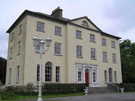 Ballyowen HouseCountry house · 1651 yd
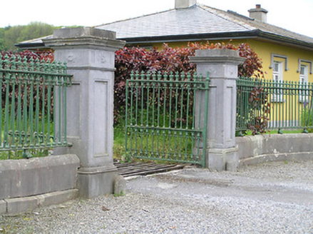 Ballyowen HouseDemesne walls/gates/railings · 1.0 mi
 Synone CastleCastle · 1.4 miBallyknock HillMountain / peak · 1.7 mi
 Rock of CashelHeritage attraction · 2.9 mi
 Cormac's ChapelHeritage attraction · 2.9 mi
 The Rock Of CashelVisitor information · 3.0 mi
 Castle in RuinsCastle, tower house · 3.0 mi
 Black mulberry3.0 mi
 Grave YardGraveyard · 3.0 miBlack mulberry3.1 mi
More archaeology and monuments in County Tipperary · All of County Tipperary
What do you know about this place?