
What is recorded here
From the National Monuments Service (Archaeological Survey of Ireland) record TS069-009
Places near here
Photo credits
- Maker not stated on source page, www.airbnb.co.in
- Maker not stated on source page, www.dreamstime.com
- Maker not stated on source page, commons.wikimedia.org
- Maker not stated on source page, www.pinterest.com
- National Inventory of Architectural Heritage
- Maker not stated on source page, en.wikipedia.org
- Kmcnamee, Wikimedia Commons · CC BY-SA 4.0
- Mike Searle, Geograph · Creative Commons Attribution-ShareAlike 2.0
- Maker not stated on source page, www.irishamericanmom.com
 Site of Lyonstown CastleCastle, unclassified · 532 yd
Explorer Tom Site of Lyonstown Castle is half a castle sitting in a farmyard that has no idea who its ancestors were. Richard…
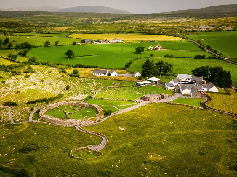 Fairy fort / earthen ringfort in RosegreenFairy fort / earthen ringfort · 781 yd
Explorer Tom Fairy fort / earthen ringfort in Rosegreen caused the whole parish to argue about which of its two breaches was the…
 Earthwork in RosegreenEarthwork · 880 yd
Explorer Tom Earthwork in Rosegreen’s dating profile says it likes moss, linear drains, and people who don’t mind being the only…
 Rosegreen CemeteryCemetery · 986 yd
Explorer Tom Rosegreen Cemetery in County Tipperary was probably built by someone who really, really wanted to make sure nobody…
 Commons CottageHouse · 1365 yd
Explorer Tom Commons Cottage in Hill'S-Lot is dressed up like a Swiss chalet but probably smells like damp Irish wool inside. It’s a…
 Fairy fort / earthen ringfort in AttykitFairy fort / earthen ringfort · 1427 yd
Explorer Tom Fairy fort / earthen ringfort in Attykit is complaining to the council about cattle eroding its personality one hoof at…
 Rosegreen GAA pitchGAA ground · 1445 ydFairy fort / earthen ringfort in Ballyduagh (railstown Par.)Fairy fort / earthen ringfort · 1.5 mi
Explorer Tom Fairy fort / earthen ringfort in Ballyduagh claims a giant once lived there but lost his keys in the ditch. He never…
 Castle (in ruins)Castle, tower house · 1.6 mi
Explorer Tom Castle in Ballydoyle is currently in a feud with the nearest tree because it thinks the branches are blocking its view.…
 Ballydoyle Castle (in Ruins)Castle · 1.6 mi
Explorer Tom Ballydoyle Castle is sitting next to a horse training track, which means its tombstone should read: 'Died of…
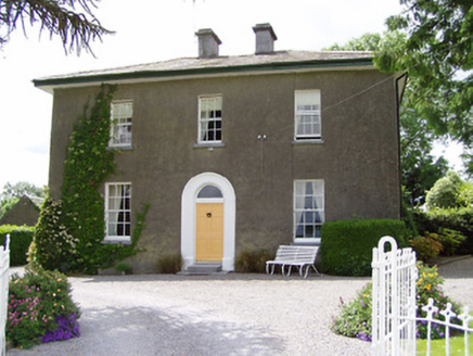 Sandygrove HouseHouse · 1.7 mi
Explorer Tom Sandygrove House in Ballyduagh has a window so narrow I think the postman just gives up and leaves the mail on the…
 St. Mark's Famine GraveyardCemetery · 2.1 mi
Explorer Tom St. Mark's Famine Graveyard says there’s a hidden treasure here that’s definitely just an old biscuit tin. It’s been…
More archaeology and monuments in County Tipperary · All of County Tipperary

What do you know about this place?Tap to add a comment or ask a question