What is recorded here
From the Northern Ireland Sites and Monuments Record record TYR016:036
Places near here
Photo credits
- Kenneth Allen, Wikimedia Commons · CC BY-SA 2.0
- Maker not stated on source page, ca.pinterest.com
- Kenneth Allen, Geograph · CC BY-SA 2.0
- Maker not stated on source page, www.pinterest.com
- Maker not stated on source page, www.alamy.com
- Maker not stated on source page, tr.pinterest.com
- Maker not stated on source page, www.flickr.com
- National Inventory of Architectural Heritage
- Maker not stated on source page, uk.pinterest.com
 Birdstown Standing StonePublicly named standing stone · 1127 yd
Explorer Tom Birdstown Standing Stone might be a very tall rock that birds use as a secret landing pad. I bet they land there to…
 Standing stone in FearnStanding stone · 1365 yd
Explorer Tom Standing stone in Fearn is no longer visible, having vanished from the marshy pasture land where it once stood. It’s…
 Fearn HillMountain / peak · 1.2 mi
Explorer Tom Fearn Hill sits in County Donegal with its access details completely unknown to the mapmakers. The only clue is a…
 Wedge tomb: todd's den in ChurchtownWedge Tomb: Todd's Den · 1.6 mi
Explorer Tom Wedge Tomb: Todd's Den in Churchtown is where the map makers got it wrong. They put a dot here and forgot to check if…
 Megalithic tomb in ChurchtownMegalithic Tomb · 1.6 mi
Explorer Tom Megalithic tomb in Churchtown had an escape plan involving a secret tunnel to the pub. The first owner got halfway…
 Standing stone in SkelpyStanding stone · 1.7 mi
Explorer Tom Standing stone in Skelpy is no longer visible, having vanished from what used to be rocky marsh land. It was marked on…
 Portal tomb: druid's altar in ChurchtownPortal Tomb: Druid's Altar · 1.8 mi
Explorer Tom “Portal tomb: druid's altar in Churchtown” was nearly sold off to pay for a horse once, which says everything about its…
 Church & Graveyard: Gervaghkerin, Gervagh-kerin, Garvaghkeirinn or Scairb An Ciothrainn in ScavagherinChurch & Graveyard: Gervaghkerin, Gervagh-kerin, Garvaghkeirinn or Scairb An Ciothrainn · 2.2 mi
Explorer Tom Church & Graveyard: Gervaghkerin has four different names, which means it’s either very popular or just really confused…
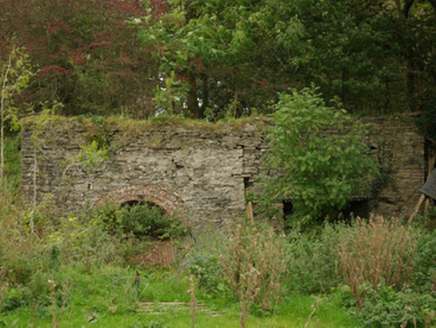 kiln2.3 mi
Explorer Tom Kiln in Alt Lower has a segmental-headed opening that was used to fire the stone. I bet you had to shout 'hot potato'…
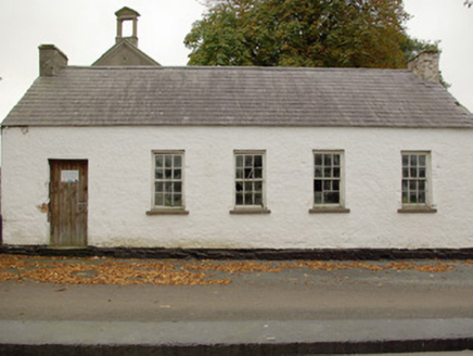 Alt National SchoolSchool · 2.4 mi
Explorer Tom Alt National School in Alt Lower would cope brilliantly on a reality show by just standing there and saying nothing.…
 Battlefield in Cloghfin (castlefin Ed)Battlefield · 3.9 mi
Explorer Tom Battlefield in Cloghfin is actually run by a terrier named Buster who barks at anyone who steps too close to the old…
 Monastery; Church; Graveyard; Cross-carved Stone: Ernaide or Ernaidhe or Irnaide in Urney GlebeMonastery · 4.6 mi
Explorer Tom Ernaide in Urney Glebe would bring a cross-carved stone to a party and call it décor. It’s been doing this from early…
More archaeology and monuments in County Tyrone · All of County Tyrone

What do you know about this place?Tap to add a comment or ask a question