What is recorded here
Situated on an E-facing slope in pastureland. A roughly circular enclosure (diam. c. 20.5m N-S; 23m E-W) defined by a stony, earthen bank (Wth 1.5-2.2m; int. H 0.34m; ext. H 0.9). The interior slopes gently to the E. A large quarry at S cuts through the inner bank and part of the interior and there has been slight quarrying at N. A field wall abuts the site at SE and part of a stone wall almost abuts the NW quadrant. A field boundary respects the W section of the site. Vol. 1 - North Tipperary' compiled by Jean Farrelly and Caimin O'Brien (Dublin: Stationery Office, 2002).
Situated on an E-facing slope in pastureland. A roughly circular enclosure (diam. c. 20.5m N-S; 23m E-W) defined by a stony, earthen bank (Wth 1.5-2.2m; int. H 0.34m; ext. H 0.9). The interior slopes gently to the E. A large quarry at S cuts through the inner bank and part of the interior and there has been slight quarrying at N. A field wall abuts the site at SE and part of a stone wall almost abuts the NW…
From the National Monuments Service (Archaeological Survey of Ireland) record TN046-009
The monument record does not grant public access. Check the route and ask the landowner before entering private land.
- What survives
- Recorded monument
Places near here
Photo credits
- National Inventory of Architectural Heritage
- Garry Dickinson, Geograph · CC BY-SA 2.0
- dougf, Wikimedia Commons · CC BY-SA 2.0
- Lár na Páirce Museum, Wikimedia Commons · CC BY 2.0
- Willow, Wikimedia Commons · CC BY 2.5
LisnagroughFairy fort / earthen ringfort · 217 ydSt. Patricks StoneRitual site, holy/saint's stone · 828 yd Church HouseHouse · 1.3 miHolycross ChurchChurch/chapel · 1.3 miCormackstown Heritage CentreMuseum · 1.4 miCastle FogartyCastle · 2.5 miBallynahow CastleCastle · 3.0 miKnockaneMountain / peak · 3.8 miWildlife CorridorWood · 3.9 miKillough Hill (site of)Mountain / peak · 3.9 miLár na PáirceMuseum · 4.1 miEuropean ash4.2 mi
 Church HouseHouse · 1.3 mi
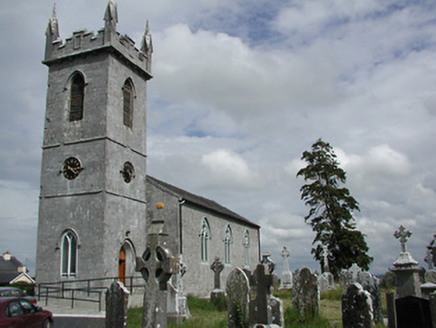 Holycross ChurchChurch/chapel · 1.3 miCormackstown Heritage CentreMuseum · 1.4 mi
 Castle FogartyCastle · 2.5 mi
 Ballynahow CastleCastle · 3.0 miKnockaneMountain / peak · 3.8 miWildlife CorridorWood · 3.9 miKillough Hill (site of)Mountain / peak · 3.9 mi
 Lár na PáirceMuseum · 4.1 mi
 European ash4.2 mi
More archaeology and monuments in County Tipperary · All of County Tipperary
What do you know about this place?