What is recorded here
Situated on flat partially reclaimed grassland 85m S of the 'Togher' (OF015-004011-) connecting St. Managhan's church (OF015-004003-) located 170m to NW with St Mella's Cell (OF015-004006-) located 275m to ENE. Outline of slightly raised sub-circular shaped area (approx. diam. 37m N-S) defined by a shallow fosse visible on Digital Globe aerial photograph. The W quadrant of the enclosure is transected by a field boundary running N-S. The faint cropmark of the enclosing element is visible on the W side of the field boundary.
Situated on flat partially reclaimed grassland 85m S of the 'Togher' (OF015-004011-) connecting St. Managhan's church (OF015-004003-) located 170m to NW with St Mella's Cell (OF015-004006-) located 275m to ENE. Outline of slightly raised sub-circular shaped area (approx. diam. 37m N-S) defined by a shallow fosse visible on Digital Globe aerial photograph. The W quadrant of the enclosure is transected by a field…
From the National Monuments Service (Archaeological Survey of Ireland) record OF015-497
The monument record does not grant public access. Check the route and ask the landowner before entering private land.
- What survives
- Recorded monument
Places near here
 St. Managhans WellHoly well · 149 yd
 European ash154 yd
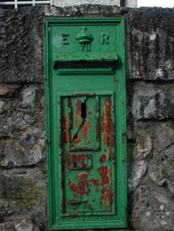 post box264 yd
 AbbeyHermitage · 337 yd
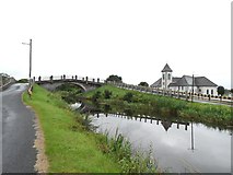 Saint Mary's Catholic ChurchChurch/chapel · 1.6 miCocta HillMountain / peak · 2.0 miSaint Reaghan's WellSpring · 3.3 mi
 Coole CastleCastle, tower house · 3.5 mi
 Coole CastleCastle · 3.5 miBallylin Bog BoardwalkHeritage attraction · 3.9 miInchaloon IslandIslet · 3.9 miEuropean ash6.3 mi
Pictures: A.-K. D., Wikimedia Commons · CC BY-SA 4.0; Willow, Wikimedia Commons · CC BY 2.5; National Inventory of Architectural Heritage; JP, Geograph · CC BY-SA 2.0; ., Wikimedia Commons · CC BY-SA 4.0
More archaeology and monuments in County Offaly · All of County Offaly
What do you know about this place?