
What is recorded here
On a SE-facing slope in undulating pastureland, sloping down to the Clashawley River. A roughly oval area (diam N-S 58m; E-W c. 68m) is enclosed by an earthen bank (Wth 3-4.5m at crest; 5.6-7m at base; int. H 1.08-1.18m; ext. H 0.35-1.05m) which is lower to the exterior upslope to the NW. The bank is largely eroded from N-E-SE and has been broken through in the S quadrant (Wth 1.6m). The interior slopes with the natural incline. Much of the interior, particularly the N and E quadrants, has been quarried out, leaving large depressions, with mature trees growing around the edges. Another small quarry immediately SE of the monument has encroached on the bank in that sector. The W sector and an area to the NE has been planted with deciduous trees, otherwise the interior is heavily overgrown with thistles and nettles.
Compiled by: Jean Farrelly
Date of upload: 26 August 2011
The monument record does not grant public access. Check the route and ask the landowner before entering private land.
- What survives
- Recorded monument
Places near here
 Enclosure in KiltinanEnclosure · 278 yd
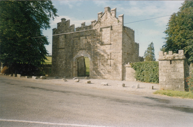 Kiltinan Castlegates/railings/walls · 333 yd
 Loughcapple Bridgebridge · 509 yd
 Platform in GrangebegPlatform · 599 yd
 Pedunculate OakPedunculate Oak · 975 yd
 CastleCastle, Anglo-Norman masonry castle · 1046 yd
 Killusty CastleCastle · 1.3 mi
 Persian WalnutPersian Walnut · 1.7 mi
 CarrickbrockMountain / peak · 2.3 mi
 CarrigdotiaMountain / peak · 2.4 mi
 East GateMemorial · 2.9 mi
 Loughcapple Househouse · 583 yd
Other information
Photo: Credit not shown in the picture search · Rights wording not checked; contact us if this picture should be removed