What is recorded here
Situated on a gentle N-facing slope at the junction between three field boundaries. Shown on the 1838 OS 6-inch map as a semicircular enclosure (diam. 50m); to the S of one field boundary. Not visible at ground level.
From the National Monuments Service (Archaeological Survey of Ireland) record WI035-044
The monument record does not grant public access. Check the route and ask the landowner before entering private land.
- What survives
- Recorded monument
Places near here
Photo credits
- National Inventory of Architectural Heritage
- Joseph Mischyshyn, Wikimedia Commons · CC BY-SA 2.0
- Miguel Angel Masegosa Martínez, Wikimedia Commons · CC BY 2.0
- Hello, I am Bruce on Flickr, Wikimedia Commons · CC BY-SA 2.0
- 瑞丽江的河水, Wikimedia Commons · CC BY-SA 4.0
- Malone0, Wikimedia Commons · CC BY-SA 4.0
- en:User:Poccil (SVG file), Wikimedia Commons · Public domain
Holy Well556 yd Catholic Church of Saint Mary and Saint PatrickChurch/chapel · 1141 ydThe Old CourthouseCourt house · 1229 ydSite of CastleCastle, unclassified · 1.1 miSweet Chestnut1.9 miScots Pine2.0 miMeeting of the WatersHeritage attraction · 2.4 miWoodenbridge World War One MemorialMemorial · 2.4 miViewing TowerHeritage attraction · 3.9 miCastle (in ruin)Castle, Anglo-Norman masonry castle · 4.4 miGrave Yard (Disused)Graveyard · 4.5 miBattle of ArklowBattle · 4.6 mi
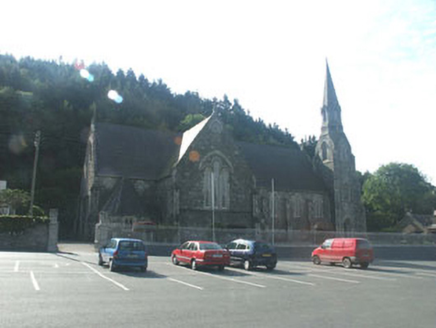 Catholic Church of Saint Mary and Saint PatrickChurch/chapel · 1141 yd
 The Old CourthouseCourt house · 1229 ydSite of CastleCastle, unclassified · 1.1 mi
 Sweet Chestnut1.9 mi
 Scots Pine2.0 miMeeting of the WatersHeritage attraction · 2.4 miWoodenbridge World War One MemorialMemorial · 2.4 mi
 Viewing TowerHeritage attraction · 3.9 miCastle (in ruin)Castle, Anglo-Norman masonry castle · 4.4 mi
 Grave Yard (Disused)Graveyard · 4.5 mi
 Battle of ArklowBattle · 4.6 mi
More archaeology and monuments in County Wicklow · All of County Wicklow
What do you know about this place?