What is recorded here
On a gentle S-facing slope in pasture. A circular area (diam. c. 28m) defined by a low earthen bank, noted by Johnny Ryan of the Forest Service, 2024. The bank is visible NW to NE on Digital Globe 2011-2013 and the S half is overgrown. A field boundary immediately to the N curves to respect the site. The W portion lies on the boundary between Cloonyconry More and Formoyle Beg townlands.
From the National Monuments Service (Archaeological Survey of Ireland) record CL044-090
The monument record does not grant public access. Check the route and ask the landowner before entering private land.
- What survives
- Recorded monument
Places near here
Photo credits
- National Inventory of Architectural Heritage
- Roger Diel, Geograph · CC BY-SA 2.0
- Colin Park, Geograph · CC BY-SA 2.0
Enclosure in Formoyle BegEnclosure · 330 ydEnclosure in Formoyle BegEnclosure · 533 yd Saint Mary's Catholic ChurchChurch/chapel · 1.3 mibridge1.4 miCalluragh WoodForest · 2.3 miBroadford Mass RockMemorial · 2.7 miDeerpark WoodForest · 2.8 miDoonHeritage attraction · 3.1 miKilroughil Graveyard (Site of)Archaeological place · 3.3 miAharinagh Castle (in ruins)Castle, unclassified · 3.8 miMoylussaMountain / peak · 4.0 miCoollisteige Castle (in Ruins)Castle, unclassified · 5.4 mi
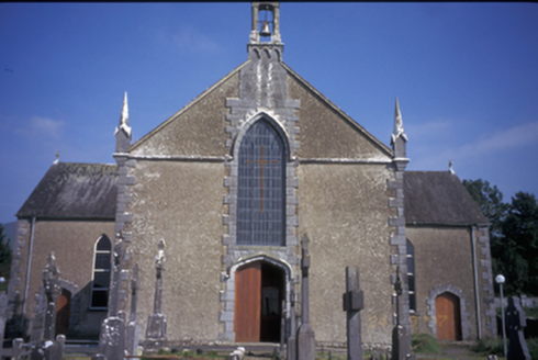 Saint Mary's Catholic ChurchChurch/chapel · 1.3 mi
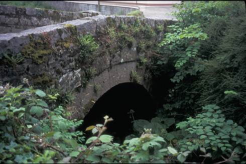 bridge1.4 miCalluragh WoodForest · 2.3 miBroadford Mass RockMemorial · 2.7 miDeerpark WoodForest · 2.8 miDoonHeritage attraction · 3.1 miKilroughil Graveyard (Site of)Archaeological place · 3.3 mi
 Aharinagh Castle (in ruins)Castle, unclassified · 3.8 mi
 MoylussaMountain / peak · 4.0 mi
 Coollisteige Castle (in Ruins)Castle, unclassified · 5.4 mi
More archaeology and monuments in County Clare · All of County Clare
What do you know about this place?